
|
|
| POLSKA | POLAND |
| województwo: Pomorskie | voivodship: Pomerania |
| powiat: Chojnice | county: Chojnice |
map →
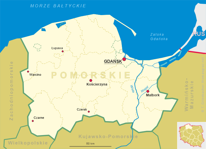

 Czersk is situated at an elevation of 128 m in the Chojnice county in the south of the Polish voivodship Pomerania.
The city has a population of about 9,400 (2004).
Czersk is situated at an elevation of 128 m in the Chojnice county in the south of the Polish voivodship Pomerania.
The city has a population of about 9,400 (2004).
A parish community was already founded in the 13th century. At that time it belonged to the duchy of Masovia. In 1309 the area came under the rule of the Teutonic Knights. By 1381, probably already before this date, the area was incorporated into the duchy of Masovia. In 1386 Czersk was granted the privileges of a town. After the First Partition of Poland in 1772 (see map), Czersk became part of Prussia (West Prussia). However, at the same time it lost its official status of a town. In 1827 a horse carriage line between Berlin to Königsberg (now Kaliningrad) was established. The opening in 1873 of the the Prussian Eastern Railroad from Berlin to Königsberg marked the beginning of a major economical development. After World War I, Czersk became part of Poland in 1920. Six years later, Czersk again received the status of a town. During World War II Czersk was occupied by German forces in 1939. In 1942 the town was renamed Heiderode (although Czersk had been the name of the community even during the 150 years of its being part of Prussia). In 1945 the town was liberated by the Red Army and, renamed Czersk again, became again part of Poland.
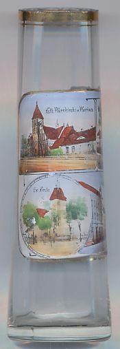
The top left picture on glass no. 2383 shows a view of the
 Catholic
The bottom left picture on glass no. 2383 shows a view of the
Protestant
The building depicted on the top right picture is identified as
The bottom right picture is labeled
Amtsgericht (local district court).
Friedrichstraße and Marktplatz.
![[scale]](lineal.jpg) contact: webmaster
contact: webmaster