
|
|
| FRANCE | FRANCE |
| région: Centre-Val de Loire | |
| département: 28, Eure-et-Loir |
map →
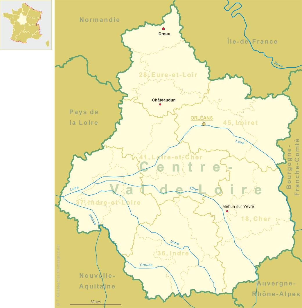
 Dreux is situated at an elevation of 116 m on the river Eure in the département Eure-et-Loir in the north of
the région Centre-Val de Loire, about 34 km north-northwest of the chef-lieu of the département, Chartres,
and about 101 km northwest of the region's capital, Orléans. The municipality has a population of about 32,700 and is the chef-lieu of the
arrondissement Dreux.
Dreux is situated at an elevation of 116 m on the river Eure in the département Eure-et-Loir in the north of
the région Centre-Val de Loire, about 34 km north-northwest of the chef-lieu of the département, Chartres,
and about 101 km northwest of the region's capital, Orléans. The municipality has a population of about 32,700 and is the chef-lieu of the
arrondissement Dreux.
The place was founded as a settlement of a small Gallic tribe, the "Durocassi". In the Roman period a stronghold named Castrum Drocas protected the crossroads of important trading routes. The Tabula Peutingeriana, a unique 13th century copy of Roman road map of the 4th/early 5th century, mentions the place under the name Durocassium. In the Middle Ages, Dreux was the centre of the Comté de Dreux. The first comte de Dreux was Robert, the son of Louis VI. The first large battle of the French Wars of Religion occurred at Dreux, on 19 December 1562, resulting in a hard-fought victory for the Catholic forces.
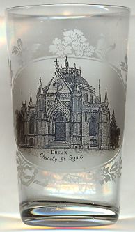
The  Chapelle royale Saint-Louis de Dreux [left]
was built in 1816 by order of Louise Marie Adélaïde de Bourbon-Penthièvre, the Duchess of Orléans,
as the final resting place for her family. The chapel is located on the site of an old mass grave of the Chanoines cemetry, where
in 1793 the remains of Louis Jean Marie de Bourbon, Duc de Penthièvre, and nine other members of the family were
thrown by a mob who had taken the bodies from their earlier burial place, the crypt of the chapel of the Collégiale Saint-Étienne de Dreux.
In 1839/1845, Louis-Philippe I, King of the French, son of the duchesse d'Orléans, embellished the chapel which was renamed Chapelle royale de Dreux,
now the necropolis of the Orléans royal family.
Chapelle royale Saint-Louis de Dreux [left]
was built in 1816 by order of Louise Marie Adélaïde de Bourbon-Penthièvre, the Duchess of Orléans,
as the final resting place for her family. The chapel is located on the site of an old mass grave of the Chanoines cemetry, where
in 1793 the remains of Louis Jean Marie de Bourbon, Duc de Penthièvre, and nine other members of the family were
thrown by a mob who had taken the bodies from their earlier burial place, the crypt of the chapel of the Collégiale Saint-Étienne de Dreux.
In 1839/1845, Louis-Philippe I, King of the French, son of the duchesse d'Orléans, embellished the chapel which was renamed Chapelle royale de Dreux,
now the necropolis of the Orléans royal family.
[Text adapted from http://en.wikipedia.org/wiki/Dreux]
![[scale]](lineal.jpg)