
|
| DEUTSCHLAND | GERMANY | |
| Bundesland: Freistaat Bayern | Bavaria | |
Regierungsbezirk: Oberpfalz
| Landkreis: Cham
|
| |
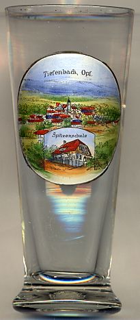
 Tiefenbach is situated at an elevation of 527 m in the Cham district in the area between the Bavarian Forest, the Bohemian Forest and the
Upper Palatinate Forest mountain ranges. The municipality has a population of about 2,100 (2008).
Tiefenbach was part of the domains of the barons of Reisach. Situated in the Electorate (1806 Kingdom) of Bavaria, the municipality of Tiefenbach was founded by the administrative reform of 1818 (Second Municipality Edict of King Maximilian I Joseph of Bavaria).
The bottom inset picture shows the
 Spitzenschule
![[scale]](lineal.jpg)