
|
|
| ČESKÁ REPUBLIKA | CZECH REPUBLIC |
| Plzeňský kraj | Plzeň region |
| Okres: Tachov |
map →
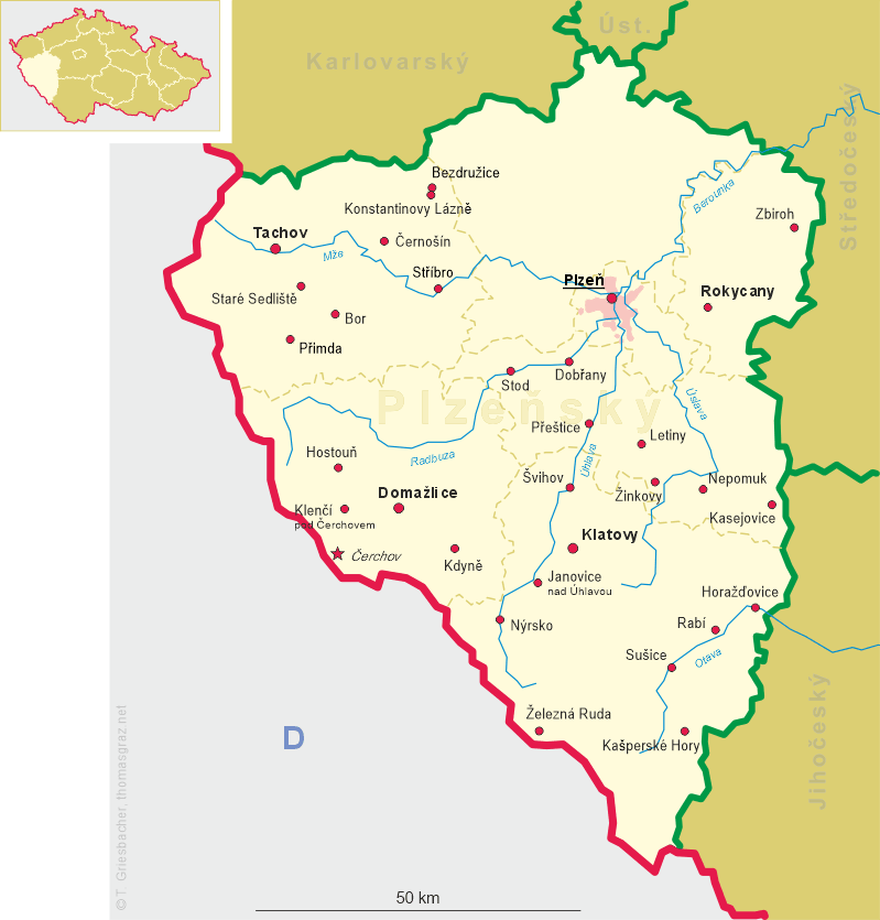
 Tachov is situated at an altielevation tude of 483 m on the river Mže in the Plzeň region of western Bohemia.
Tachov is the capital of the district of the same name. The municipality has a population of about 13,000 (2006).
Tachov is situated at an altielevation tude of 483 m on the river Mže in the Plzeň region of western Bohemia.
Tachov is the capital of the district of the same name. The municipality has a population of about 13,000 (2006).
The area was inhabited by humans around 8,000–6,000 BC. The first written document mentioning Tachov comes from 1115. A period of ravishing boom came over the place under Přemysl Otakar II who had a new castle with a mighty round tower built here. He also founded a town near the castle. During the Hussite wars the city was besieged and conquered several times. During the Thirty Years' War (1618–1648) the city was damaged considerably. In 1664, the Losy family became the new proprietor; their descendants passed the title to the Windisch-Grätz family in 1784. The Losys started a conversion of the medieval castle to a large Baroque château. The Windisch-Grätzs, in their turn, made large investments to rebuild the house in classical style. In 1945 most German-speaking inhabitants, the majority in the city, were expelled.
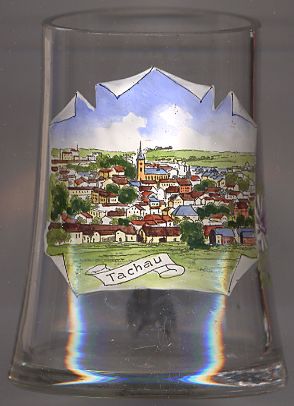
The  church of the Assumption of the Virgin Mary (kostel Nanebevzetí Panny Marie) [background centre]
was first built as a Gothic church in the 14th century. Throughout the later centuries it was modified several times.
The last reconstruction, in Gothic revival style, took place in 1904–1908. The interior decorations date from 1670.
church of the Assumption of the Virgin Mary (kostel Nanebevzetí Panny Marie) [background centre]
was first built as a Gothic church in the 14th century. Throughout the later centuries it was modified several times.
The last reconstruction, in Gothic revival style, took place in 1904–1908. The interior decorations date from 1670.
[Text adapted from http://en.wikipedia.org/wiki/Tachov]
![[scale]](lineal.jpg)