
|
|
| MAGYARORSZÁG | HUNGARY |
| megye: Veszprém |
map →
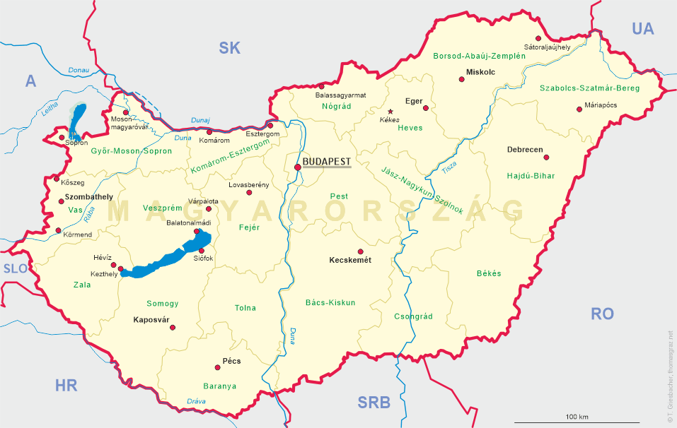
 Várpalota is situated at an altitutde of 152 m in the eastern slopes of the Bakony mountain region about 70 km southwest of
Budapest and about halfway between the county seats Székesfehérvár and Veszprém.
The municipality has a population of about 20,700 (2009).
Várpalota is situated at an altitutde of 152 m in the eastern slopes of the Bakony mountain region about 70 km southwest of
Budapest and about halfway between the county seats Székesfehérvár and Veszprém.
The municipality has a population of about 20,700 (2009).
The town's origins are linked to the Roman and Avar periods, as testified verified by burial mounds, tombstones and Roman artifacts in the outskirts of the town.
In the Middle Ages it was a flourishing market town. In the 20th century it became a center for coal mining.
The upper horizon of mining started in 1887 and was 15 metres under the surface; the deepest gallery was some 36 metres below the surface.
Coal-mining surged in 1903 when the Prussian count Henrik Witzleben-Aldöbern purchased a part of the Zichy estate together with the mine.
He also led water from the Szélhely spring into the village and constructed public wells. Count Witzleben founded an industrial plant in the
vicinity of Várpalota railway station, an industrial railway and brickworks. In 1907 the company was transformed into a limited company under
the name Várpalotai Ipartelepek (Várpalota Industrial Plants) and in 1920 the Unió Bányászati és Ipari R.T. (Union Mining and Industrial Co. Ltd.)
was founded. The mine produced most in 1942 (710,000 metric tons). In the 1980's coal production decreased. Plants of ex-Várpalota Szénbányák
(Várpalota Coal-Mines) came under the management of Veszprémi Szénbányák (Veszprém Coal-Mines).
[Text adapted from http://en.wikipedia.org/wiki/Várpalota, http://www.palotanet.hu/index.php?gr_1_id=3&gr_2_id=18&gr_3_id=0&doc_id=194]
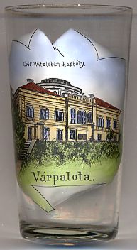
The picture on glass no. 2653 [left] shows a view of the
 château
![[scale]](lineal.jpg)