
|
|
| FRANCE | FRANCE |
| région: Nouvelle-Aquitaine | |
| département: 86, Vienne |
map →

Poitiers is situated at an elevation of 111 m on the river Clain in the département Vienne of the région Nouvelle-Aquitaine. Poitiers is the capital of the département and also the sous-préfecture of the arrondissement Poitiers and the chef-lieu of 7 cantons (Poitiers-1 to 7). It was the capital of the région Poitou-Charentes until 31 December 2015 when that region was merged with Aquitaine and Limousin (the capital of the new region Nouvelle-Aquitaine is Bordeaux. The municipality of Poitiers has a population of about 89,300 (2007). Poitiers is strategically situated on the Seuil du Poitou, a shallow zone which is a gap between the Armorican and the Central Massif and connects the Aquitaine Basin to the Paris Basin. Poitiers's primary site sits on a vast promontory between the valleys of the Boivre and the Clain. The old town occupies the slopes and summit of a plateau which rises 40 m above the streams which surround it on three sides.
Poitiers was founded by the Celtic Pictones tribe as the oppidum Lemonum before Roman influence. The name is said to have come from the Celtic word for elm, Lemo.
Until 1857 Poitiers contained the ruins of a vast Roman amphitheatre larger than that of Nîmes. Remains of Roman baths, built in the 1st century and demolished in the
3rd century, were laid bare in 1877. The Romans also built at least three aqueducts. This extensive ensemble of Roman constructions suggests Poitiers was a town of
first importance, possibly even the capital of the Roman province of Gallia Aquitania during the 2nd century. As Christianity was officialized and introduced across
the Roman Empire during the 3rd and 4th centuries, the first bishop of Poitiers from 350 to 367, Saint Hilarius, evangelized the city. In the 4th century, a thick wall
six meters wide and ten meters high was built around the city. At this time, the town began to be known as Poitiers, after the original Pictones inhabitants.
Fifty years later the city fell into the hands of the Visigoths, and became one of the principal residences of their kings. The Visigoths were defeated at Vouillé,
not far from Poitiers, in 507, and the town came under Frankish dominion.
During most of the Early Middle Ages, the town of Poitiers took advantage of its defensive site and of its location, which was far from the centre of Frankish power.
As the seat for an évêché (bishop) since the 4th century, the town was the capital of the Poitou county. The Counts of Poitiers governed a large domain, including
both Aquitaine and Poitou. The first decisive Christian victory over the Umayyad Caliphate — the Battle of Tours — was fought by
Charles Martel's men in the vicinity of Poitiers on 10 October 732. The Battle of Poitiers was fought at Poitiers on 19 September 1356,
during the Hundred Years' War (1337–1453). In 1418, the royal parliament moved from Paris to Poitiers, where it remained in exile until
the Plantagenets withdrew from the capital in 1436. During this interval (1429) Joan of Arc was subjected to a formal inquest in the town. The University of Poitiers
was founded in 1431. The town saw less activity during the Renaissance. In the 18th century the city at this time lived mostly off of its administrative functions:
royal justice, évêché, monasteries and the intendance of the Généralité du Poitou. During the 19th century, many army bases were built in Poitiers because of its
central and strategic location. Poitiers became a garrison town, despite its distance from France's borders. The train station was built in the 1850s. Poitiers was
bombed during World War II, particularly the area round the railway station which was heavily hit on 13 June 1944. During the late fifties until the late sixties
the U.S. Army and U.S. Air Force had an array of military installations in France, including a major Army logistics and communications hub in Poitiers, part of what was
called the Communication Zone (ComZ), and consisting of a logistics headquarters and communications agency. In the 1970s the city benefited from industrial décentralisation.
[Text adapted from http://en.wikipedia.org/wiki/Poitiers]
 The
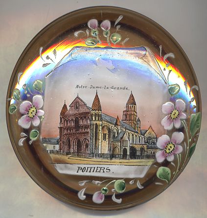
The  Église Notre-Dame-la-Grande [left]
has a double status, collegial and parochial, and forms part of the Catholic diocese of Poitiers.
The church is mentioned in the 10th century, under the name of Sancta Maria Maior. The whole of the building was rebuilt during the second half of the 11th century,
in the period of High Romanesque, and was dedicated in 1086 by Otho de Lagery, cardinal bishop of Ostia and Velletri, who two years later was elected Pope Urban II.
In the second quarter of the 12th century, the old bell-tower-porch on the frontage was shaved, and the church enlarged by two spans to the west. In the south, the
turret of a staircase marks the site of this enlarging. It is at that time that the celebrated frontage-screen was built. Private vaults were added to the Romanesque frame
during the 15th and 16th centuries. Of flamboyant Gothic style, they belonged to the middle-class families of the city, who had been merchants since the end of the Middle Ages.
Église Notre-Dame-la-Grande [left]
has a double status, collegial and parochial, and forms part of the Catholic diocese of Poitiers.
The church is mentioned in the 10th century, under the name of Sancta Maria Maior. The whole of the building was rebuilt during the second half of the 11th century,
in the period of High Romanesque, and was dedicated in 1086 by Otho de Lagery, cardinal bishop of Ostia and Velletri, who two years later was elected Pope Urban II.
In the second quarter of the 12th century, the old bell-tower-porch on the frontage was shaved, and the church enlarged by two spans to the west. In the south, the
turret of a staircase marks the site of this enlarging. It is at that time that the celebrated frontage-screen was built. Private vaults were added to the Romanesque frame
during the 15th and 16th centuries. Of flamboyant Gothic style, they belonged to the middle-class families of the city, who had been merchants since the end of the Middle Ages.
[Text adapted from http://en.wikipedia.org/wiki/Église_Notre-Dame-la-Grande]

![[scale]](lineal.jpg)