
|
|
| UNITED STATES OF AMERICA | |
| MINNESOTA | |
| Hennepin County |
map →

Minneapolis, nicknamed "City of Lakes" and the "Mill City", is the county seat of Hennepin County, the largest city in the state of Minnesota, and the 48th largest in the United States. Its name is attributed to the city's first schoolteacher, who combined mni, a Dakota Sioux word for water, and polis, the Greek word for city. As of the 2010 census, the estimated population of the city of Minneapolis is 387,753. Minneapolis lies on both banks of the Mississippi River, just north of the river's confluence with the Minnesota River, and adjoins Saint Paul, the state's capital. Known as the Twin Cities, Minneapolis–Saint Paul is the 16th-largest metropolitan area in the U.S., with approximately 3.3 million residents. The city is abundantly rich in water, with over twenty lakes and wetlands, the Mississippi river, creeks and waterfalls, many connected by parkways in the Chain of Lakes and the Grand Rounds National Scenic Byway.
Dakota Sioux were the region's sole residents until French explorers arrived around 1680. The United States government pressed the Mdewakanton band of the Dakota to sell their land, allowing people arriving from the east to settle there. The Minnesota Territorial Legislature authorized present-day Minneapolis as a town on the Mississippi's west bank in 1856. Minneapolis incorporated as a city in 1867, the year rail service began between Minneapolis and Chicago. It later joined with the east-bank city of St. Anthony in 1872. Minneapolis grew up around Saint Anthony Falls, the highest waterfall on the Mississippi. Millers have used hydropower elsewhere since the 1st century B.C., but the results in Minneapolis between 1880 and 1930 were so remarkable the city has been described as "the greatest direct-drive waterpower center the world has ever seen." During the 1950s and 1960s, as part of urban renewal, the city razed about two hundred buildings across twenty-five city blocks — roughly 40% of downtown, destroying the Gateway District and many buildings with notable architecture including the Metropolitan Building. Efforts to save the building failed but are credited with sparking interest in historic preservation in the state.
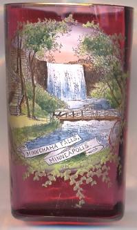
 Minnehaha Falls [left] are located on Minnehaha Creek, a tributary of the Mississippi River, near its confluence with the
Mississippi. The site is not far from Fort Snelling, one of the earliest white settlements in the region. The falls are now located in Minnehaha Park.
While the name is often translated as "Laughing Water", the correct translation is "curling water" or "waterfall". The name comes from the Dakota language
elements mni, meaning water, and ȟaȟa, meaning waterfall. The "Laughing Water" translation comes from Mary Eastman's book Dacotah,
published in 1849. On the Fort map of 1823, the falls were named Brown's Falls. The Dakota called Minnehaha Creek, "Wakpa Cistinna", meaning "Little River".
The falls became a tourist destination, especially after the 1855 publication of The Song of Hiawatha by Henry Wadsworth Longfellow. However, Longfellow never visited the
falls himself. He was inspired by the stories of Mary Eastman and Henry Rowe Schoolcraft and by a photograph of the falls. Beginning in 1885, the state legislature began acquiring
the land to become the first Minnesota State Park. But in 1889, it was turned over to the city of Minneapolis for a city park.
Today, the falls are located near the entrance of Minnehaha Park in Minneapolis. The 193-acre (78 hectare) park is divided into two main portions: an upper section above the falls which is
kept trimmed and maintained like many other city parks, and the lower section which is largely left in a natural state which is largely popular for free climbing due to the steep terrain.
Due to the extremely cold temperatures in the area during the winter months, the falls freeze, creating a dramatic cascade of ice that can last well into the spring. If there is a rain
shortage in the autumn, the falls may virtually dry up. In the summer, especially in the rainy months of June and July, the flow can be surprisingly forceful.
Minnehaha Falls [left] are located on Minnehaha Creek, a tributary of the Mississippi River, near its confluence with the
Mississippi. The site is not far from Fort Snelling, one of the earliest white settlements in the region. The falls are now located in Minnehaha Park.
While the name is often translated as "Laughing Water", the correct translation is "curling water" or "waterfall". The name comes from the Dakota language
elements mni, meaning water, and ȟaȟa, meaning waterfall. The "Laughing Water" translation comes from Mary Eastman's book Dacotah,
published in 1849. On the Fort map of 1823, the falls were named Brown's Falls. The Dakota called Minnehaha Creek, "Wakpa Cistinna", meaning "Little River".
The falls became a tourist destination, especially after the 1855 publication of The Song of Hiawatha by Henry Wadsworth Longfellow. However, Longfellow never visited the
falls himself. He was inspired by the stories of Mary Eastman and Henry Rowe Schoolcraft and by a photograph of the falls. Beginning in 1885, the state legislature began acquiring
the land to become the first Minnesota State Park. But in 1889, it was turned over to the city of Minneapolis for a city park.
Today, the falls are located near the entrance of Minnehaha Park in Minneapolis. The 193-acre (78 hectare) park is divided into two main portions: an upper section above the falls which is
kept trimmed and maintained like many other city parks, and the lower section which is largely left in a natural state which is largely popular for free climbing due to the steep terrain.
Due to the extremely cold temperatures in the area during the winter months, the falls freeze, creating a dramatic cascade of ice that can last well into the spring. If there is a rain
shortage in the autumn, the falls may virtually dry up. In the summer, especially in the rainy months of June and July, the flow can be surprisingly forceful.
[Text adapted from http://en.wikipedia.org/wiki/Mineapolis,_Minnesota; http://en.wikipedia.org/wiki/Minnehaha_Falls]
![[scale]](lineal.jpg)