
|
|
| SCHWEIZ / SUISSE / SVIZZERA / SVIZRA | SWITZERLAND |
| Bern / Berne / Berna / Berna |
map →
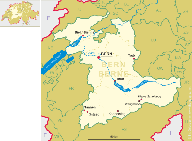
 Kandersteg is situated at an elevation of 1,904 m in the Frutigen-Niedersimmental administrative district in the canton of Bern in Switzerland.
It is located along the valley of the River Kander, west of the Jungfrau massif. The municipality has a population of about 1,240 (2012).
Kandersteg is situated at an elevation of 1,904 m in the Frutigen-Niedersimmental administrative district in the canton of Bern in Switzerland.
It is located along the valley of the River Kander, west of the Jungfrau massif. The municipality has a population of about 1,240 (2012).
Kandersteg is first mentioned, together with Kandergrund, in 1352 as der Kandergrund. Until 1909 Kandersteg was politically and religiously part of Kandergrund. In 1511 the parish built a chapel in Kandersteg, which survived the iconoclasm of the Protestant Reformation in 1530. It became a filial church of the parish in Kandergrund between 1840 and 1860 and in 1910 became the parish church of the Kandersteg parish. A Roman Catholic church was built in 1927. Traditionally the local economy relied on seasonal alpine herding and farming and supporting trade over the alpine passes. In the 17th and 18th century they began mining sulfur in the Oeschinenalp. A match factory opened in the village in the 19th century to take advantage of the sulfur. Beginning around 1850, the municipality grew into a tourist destination. Between 1855 and 1890 five hotels opened and by 1913 there were 19 hotels. The population grew dramatically during construction of the Lötschberg Tunnel and the Lötschberg railway line (Bern–Brieg) between 1906 and 1913. The new railroad line and tunnel allowed ever increasing numbers of tourists to visit Kandersteg. A chair lift to Oeschinen Lake opened in 1948, followed by a cable car to the valley floor in 1951. A ski jump was built in 1979. The Kandersteg International Scout Centre opened in 1923.
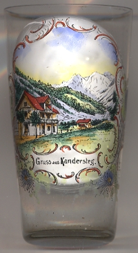
The  Blüemlisalp (Blümlisalp, 3,661 m) [background] is part of the Bernese Alps.
[http://en.wikipedia.org/wiki/Kandersteg, https://de.wikipedia.org/wiki/Blüemlisalp]
![[scale]](lineal.jpg)