
|
|
| DEUTSCHLAND | GERMANY |
| Bundesland: Freistaat Sachsen | Saxony |
| Landkreis: Zwickau |
map →

 Ebersbrunn is situated at an elevation of 508 m just southwest of the district town Zwickau
in western Saxony. The village of Ebersbrunn has a population of about 1,200 (2014) and is part of the municipality of
Lichtentanne. Ebersbrunn is also known as the source of he river Pleiße, which rises here at an elevation of
443 m and, flowing north, empties after some 90 km into the river Weiße Elster at Leipzig.
Ebersbrunn is situated at an elevation of 508 m just southwest of the district town Zwickau
in western Saxony. The village of Ebersbrunn has a population of about 1,200 (2014) and is part of the municipality of
Lichtentanne. Ebersbrunn is also known as the source of he river Pleiße, which rises here at an elevation of
443 m and, flowing north, empties after some 90 km into the river Weiße Elster at Leipzig.
The place (source of the river Pleiß) was first mentioned in 1118 in the deed of donation of the cathedral of Zwickau. A moated castle named Ebersbrunn, disappeared in the meantime, already existed before 1300. In 1893, Ebersbrunn was connected to the railway line Zwickau – Falkenstein. In 1997, Ebersbrunn with its subdivision Hüttelsgrün was incorporated into the municipality of Lichtentanne. In 1999, Hüttelsgrün was separted from Lichtentanne and was incorporated into Zwickau.
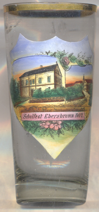
Glass no. 3181 [left] shows the
[https://de.wikipedia.org/wiki/Ebersbrunn_(Lichtentanne); http://fallingrain.com/world/GM/13/Ebersbrunn.html,
http://www.gemeinde-lichtentanne.de/inhalte/lichtentanne/_inhalt/unsere_gemeinde/ortsteile/ebersbrunn/ebersbrunn]
 school. The primary school was
closed in 2001.
school. The primary school was
closed in 2001.
![[scale]](lineal.jpg) contact: webmaster
contact: webmaster