
|
|
| DEUTSCHLAND | GERMANY |
| Bundesland: Hessen | Hesse |
| Regierungsbezirk: Gießen | |
| Landkreis: Marburg-Biedenkopf |
map →
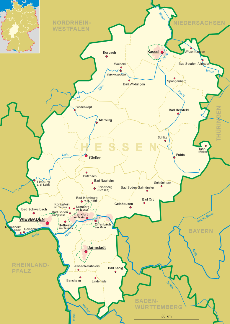
 Biedenkopf is situated at an elevation of 290 m on the upper Lahn river, in the west of the district
Marburg-Biedenkopf. The municipality has a population of about 13,700 (2016).
Biedenkopf is situated at an elevation of 290 m on the upper Lahn river, in the west of the district
Marburg-Biedenkopf. The municipality has a population of about 13,700 (2016).
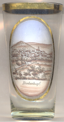
Biedencaph was first mentioned in 1196. Around 1231, the castle came in possession of the landgraves of Thuringia who founded the settlement below the castle. From 1302, Biedenkopf was in possession of the landgraves of Hesse who, however, frequently pawned the town to various families. During that time, Bieenkopf became the centre of an 'Amt' (district). In modern times, the district Biedenkopf was created in 1832. The Upper Lahn Valley Railroad from Kreuztal vie Bidenkopf to Cölbe was completed in 1883. In 1974, the former districts of Biedenkopf and Marburg were merged to the new district Marburg-Biedenkopf, which in 1981 was re-allocated from the administrative district Kassel to the administrative district Gießen.
The Protestant  Town Church [background right] was originally built around
1250, dedicated to St. John the Baptist as an early Gothic three-naved hall church. The old church survived the great
fire of 1690, a looting and fire in 1647 and also the last great town fire of 1717. However, by 1860 the church had fallen
into dereliction. Therefore, in 1888–1891 the old church was replaced by the present town curch in Gothic revival
style.
Town Church [background right] was originally built around
1250, dedicated to St. John the Baptist as an early Gothic three-naved hall church. The old church survived the great
fire of 1690, a looting and fire in 1647 and also the last great town fire of 1717. However, by 1860 the church had fallen
into dereliction. Therefore, in 1888–1891 the old church was replaced by the present town curch in Gothic revival
style.
[https://de.wikipedia.org/wiki/Biedenkopf;
https://de.wikipedia.org/wiki/Bahnstrecke_Kreuztal–Cölbe;
https://de.wikipedia.org/wiki/Stadtkirche_Biedenkopf]
![[scale]](lineal.jpg) contact: webmaster
contact: webmaster