
|
|
| SCHWEIZ / SUISSE / SVIZZERA / SVIZRA | SWITZERLAND |
| Zürich / Zurich / Zurigo / Turitg |
map →
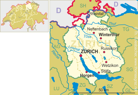
 Russikon is situated at an elevation of 608 m in the hill country between the Kempt and Töss valleys
in the north of the Swiss canton Thurgau. The municipality has a population of about 4,400 (2016) and also includes
the villages Rumlikon and Madetswil and the hamlets Sennhof, Wilhof, Gündisau and Ludetswil.
Russikon is situated at an elevation of 608 m in the hill country between the Kempt and Töss valleys
in the north of the Swiss canton Thurgau. The municipality has a population of about 4,400 (2016) and also includes
the villages Rumlikon and Madetswil and the hamlets Sennhof, Wilhof, Gündisau and Ludetswil.
A document of 775 mentions Hroadgisinchova, although it is not sure whether this actually refered to what today is Russikon. A document of 1247 mentions it as Rusinchon. During the 8th century, the area had been in possession of the monastery of Sankt Gallen, while the jurisdiction lay mostly in the hands of the Counts of Kyburg. Together with the county of Kyburg, Russikon came in possession of Zurich provisionally in 1424, then finally in 1452.
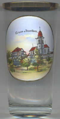
The  parish church goes back to the Romanesque period. It was first mentioned
in 1275. The core of the present church dates from 1519–1523.
parish church goes back to the Romanesque period. It was first mentioned
in 1275. The core of the present church dates from 1519–1523.
[https://de.wikipedia.org/wiki/Russikon, https://en.wikipedia.org/wiki/Russikon, http://mobile.hls-dhs-dss.ch/m.php?article=D123.php]
![[scale]](lineal.jpg)