
|
|
| DEUTSCHLAND | GERMANY |
| Bundesland: Schleswig-Holstein | |
| Kreis: Ostholstein |
map →
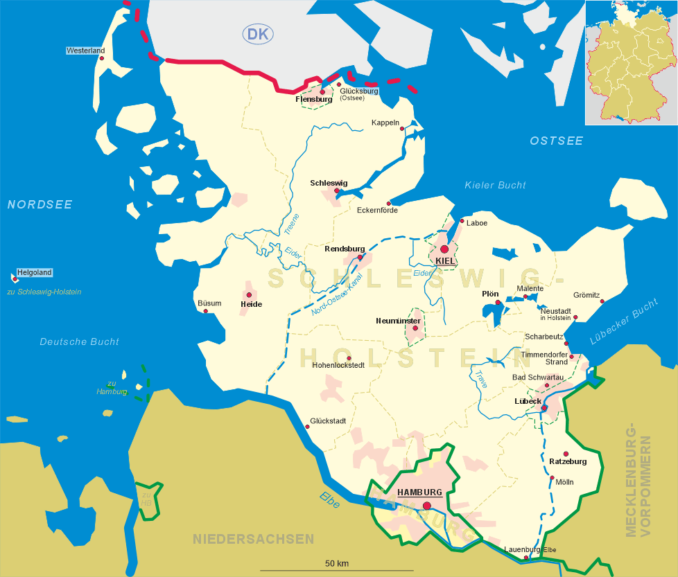
 Scharbeutz is situated at an elevation of 126 m on the Bay of Lübeck
at the eastern coast of Schleswig-Holstein. The municipality consists of the two principal parts Scharbeutz and
Pönitz as well as of the localities Gleschendorf, Haffkrug, Gronenberg, Klingberg, Sarkwitz, Schulendorf,
Schürsdorf und Wulfsdorf. The municipality has a populationn of about 11,200 (2017).
Scharbeutz is situated at an elevation of 126 m on the Bay of Lübeck
at the eastern coast of Schleswig-Holstein. The municipality consists of the two principal parts Scharbeutz and
Pönitz as well as of the localities Gleschendorf, Haffkrug, Gronenberg, Klingberg, Sarkwitz, Schulendorf,
Schürsdorf und Wulfsdorf. The municipality has a populationn of about 11,200 (2017).
Pönitz was first mentioned as Penze in 1221, Gleschendorf as Golesko in 1259 and Scharbeutz as
Scarbuce in 1271. In the 15th century the area was dominated by the charterhouse of Ahrensbök, in the
17th century it was influenced by the Danish. A proper development in the coastal region only started in the
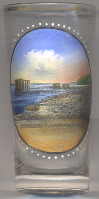
19th century. Seaside bathing tourism began in the early 19th century. The first seaside resorts,
Elisabethbad in Haffkrug and Augustusbad in Scharbeutz, were founded in 1840 and 1950, respectively. Until 1937
the area belonged to Oldenburg territories; with the Greater Hamburg
Act of 1937 the Oldenburg territory of Lübeck (Principality of Lübeck) became part of the Prussian province
of Schleswig-Holstein as district Eutin. Parts of the neighbouring municipality of Ratekau were incorporated into the
municipality of Haffkrug-Scharbeutz in 1971. In 1974 the municipalities of Gleschendorf and Haffkrug-Scharbeutz were
merged into the new municipality of Scharbeutz.
[https://de.wikipedia.org/wiki/Scharbeutz]
![[scale]](lineal.jpg)