
|
|
| ČESKÁ REPUBLIKA | CZECH REPUBLIC |
| Vysočina | Highlands (Jihlava) region |
| Okres: Havlíčkův Brod |
map →
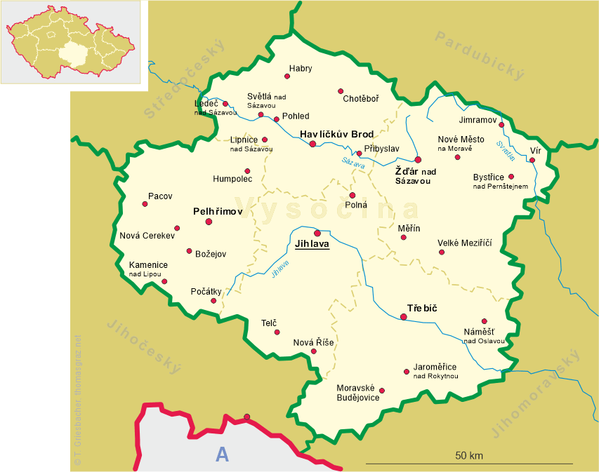
 Pohled (former German name: Frauental or also Frauenthal) is situated at an elevation of 437 m
on the right bank of the Sázava river, about 5 km northwest of the district town
Havličkův Brod. The municipality of Phled has a population of about 760 (2019).
Pohled (former German name: Frauental or also Frauenthal) is situated at an elevation of 437 m
on the right bank of the Sázava river, about 5 km northwest of the district town
Havličkův Brod. The municipality of Phled has a population of about 760 (2019).
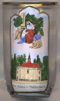
The local parish church was founded in 1265 together with the monastery Vallis Sancta Mariae ('Our Lady's Valley', which is also the meaning of the German name, Frauental). The monastery of Cistercian nuns remained one of the smaller convents of the order in Bohemia. The monastery was dissolved in 1782. After the abolition of manorialism, the municipality of Frauental was established in 1848.
The  pilgrimage church of St. Anne [left] was built in 1766 by the
architect Johann Blasius Santini-Aichl.
pilgrimage church of St. Anne [left] was built in 1766 by the
architect Johann Blasius Santini-Aichl.
[https://de.wikipedia.org/wiki/Pohled]
![[scale]](lineal.jpg)