
|
|
| DEUTSCHLAND | GERMANY |
| Bundesland: Freistaat Bayern | Bavaria |
| Regierungsbezirk: Oberbayern | |
| Landkreis: Traunstein |
map →

Unterwössen is situated at an elevation of 555 m in the valley of the river Tiroler Achen in the south the district Traunstein of Upper Bavaria. The municipality has a total population of about 3,500 (2018), divided into 31 localities.
 Wezzen was first mentioned in a written document dating from 1120. From 1255 until 1505 the Achen valley was
part of Lower Bavaria. During that period, the village was known as Niederwessen (as opposed to Oberwessen,
first mentioned in 1420). The municipality of Niederwessen (Unterwessen) was established in 1817/1818. Tourism began
after the regional railway line from Übersee to Marquardstein was completed in 1884. (Alt-)Marquartstein was
separated from the municipality in 1938; Oberwössen was incorporated into the municipality in 1972.
Wezzen was first mentioned in a written document dating from 1120. From 1255 until 1505 the Achen valley was
part of Lower Bavaria. During that period, the village was known as Niederwessen (as opposed to Oberwessen,
first mentioned in 1420). The municipality of Niederwessen (Unterwessen) was established in 1817/1818. Tourism began
after the regional railway line from Übersee to Marquardstein was completed in 1884. (Alt-)Marquartstein was
separated from the municipality in 1938; Oberwössen was incorporated into the municipality in 1972.
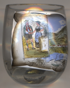
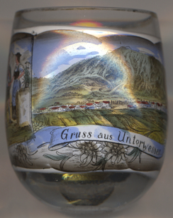
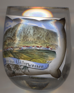
Glass no. 3734 [left] is labled Gruss aus Unterwessen ('greetings from Unterwessen'). No
online information could be found on when the name of the mmunicipality was ofifcially changed from Unterwessen
to Unterwössen. Old picture postcards up until the middle of the first decade of the 20th century
always spelled the name with 'e', while later postcards invariably use the spelling with 'ö'.
[https://de.wikipedia.org/wiki/Unterwössen, http://www2.unterwoessen.de/buerger/geschichte/ueberblick.shtml,
http://gtev-unterwoessen.de/page/unser-dorf-unterwoessen]
![[scale]](lineal.jpg)