
|
|
| DEUTSCHLAND | GERMANY |
| Bundesland: Baden-Württemberg | |
| Regierungsbezirk: Freiburg | |
| Landkreis: Lörrach |
map →

 Lörrach is situated at an elevation of 264 m in the extreme southwest of Germany, less than 5 km from
the tripoint of Germany, France and Switzerland. The municipality of Lörrach has a population of about 49,300 (2018).
Lörrach is situated at an elevation of 264 m in the extreme southwest of Germany, less than 5 km from
the tripoint of Germany, France and Switzerland. The municipality of Lörrach has a population of about 49,300 (2018).
Lorracho was first mentioned in a written document dating from 1102. In 1403 it obtained the privileges as a market town from Ruprecht (Rupert) of the Palatinate, King of Germany. The privileges of a town were obtained in 1682 from Margrave Friedrich VII of Baden-Durlach. In 1863, Lörrach became the administrative centre of the district of the same name. Stetten was incorporated into Lörrach in 1908, Tüllingen and Tumringen followed in 1935, Haagen in 1974, and Brombach and Hauingen in 1975.
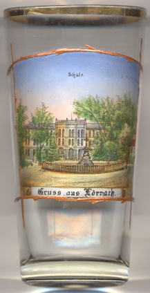
Glass no. 3761 [left] shows a view of the
 school building
[https://de.wikipedia.org/wiki/Lörrach; https://en.wikipedia.org/wiki/Lörrach;
https://amtsgericht-loerrach.justiz-bw.de/pb/,Lde/Startseite/Das+Amtsgericht/Geschichte]
![[scale]](lineal.jpg)