
|
|
| DEUTSCHLAND | GERMANY |
| Bundesland: Hessen | Hesse |
| Kreis: Main-Kinzig-Kreis |
map →
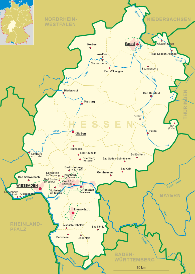
Bad Orb is situated at an elevation of 189 m on the river Orb in the wooded hills of the Spessart low mountain region in the Main-Kinzig district, about 14 km east of the district town Gelnhausen. The municipality has a population of about 10,000 (2018).
 The region was inhabited by Celts by c. 650 BC, but it is not known whether they were aware of the local salt deposits.
In 1054 it came in possession of the monastery of St. Stephan in Mainz, thus coming under
the control of the Electorate of Mainz, a part of which it remained until 1803. Orb was first documented in 1059. Orb was
referred to as a town for the first time in the 13th century. The extraction of salt from several salt springs formed
the town. Salt production reached its high point in the 17th and 18th centuries. Following the Reichsdeputationshuptschluss
of 1802 (mediatisation), by way of the Principality of Aschaffenburg and the Grand Duchy of
Frankfurt, Orb eventually became part of the Kingdom of Bavaria in 1814. Spa activities started as
early as 1837. After the Austro-Prussian War of 1866, the town became Prussian in 1867. After 1900, brine began to be used
as an alternative medicine. Commercial Salt production, however, was discontinued in 1899. Bad Orb was named a
nationally certified spa town in 1909. The remaining salina today is used for medical treatments, especially inhalation and
relaxation. After World War II, the Prussian state was dissolved and Bad Orb in 1947 became part of Germany's state
of Hesse.
The region was inhabited by Celts by c. 650 BC, but it is not known whether they were aware of the local salt deposits.
In 1054 it came in possession of the monastery of St. Stephan in Mainz, thus coming under
the control of the Electorate of Mainz, a part of which it remained until 1803. Orb was first documented in 1059. Orb was
referred to as a town for the first time in the 13th century. The extraction of salt from several salt springs formed
the town. Salt production reached its high point in the 17th and 18th centuries. Following the Reichsdeputationshuptschluss
of 1802 (mediatisation), by way of the Principality of Aschaffenburg and the Grand Duchy of
Frankfurt, Orb eventually became part of the Kingdom of Bavaria in 1814. Spa activities started as
early as 1837. After the Austro-Prussian War of 1866, the town became Prussian in 1867. After 1900, brine began to be used
as an alternative medicine. Commercial Salt production, however, was discontinued in 1899. Bad Orb was named a
nationally certified spa town in 1909. The remaining salina today is used for medical treatments, especially inhalation and
relaxation. After World War II, the Prussian state was dissolved and Bad Orb in 1947 became part of Germany's state
of Hesse.
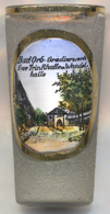
The picture on glass no. 3798 shows the  Gradierwerk new pump
[https://de.wikipedia.org/wiki/Bad_Orb, https://en.wikipedia.org/wiki/Bad_Orb]
![[scale]](lineal.jpg)