
|
|
| DEUTSCHLAND | GERMANY |
| Bundesland: Baden-Württemberg | |
| Regierungsbezirk: Stuttgart | |
| Landkreis: Schwäbisch Hall |
map →

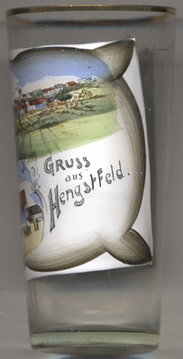 Hengstfeld is situated at an elevation of 508 m in the east of the district
Schwäbisch Hall in the northeast of Germany's state of Baden-Württemberg.
Until 1974 it was an independent municipality. On 1 July 1974 it was merged into the municipality of
Wallhausen.
Hengstfeld is situated at an elevation of 508 m in the east of the district
Schwäbisch Hall in the northeast of Germany's state of Baden-Württemberg.
Until 1974 it was an independent municipality. On 1 July 1974 it was merged into the municipality of
Wallhausen.
Although archaeological finds demonstrate settlements in the pre-Roman period and in the early Middle Ages, there does not seem to have been a continuous settlement. The oldest known written document mentioning Hengesfelt dates from 1230. The parish of Hengstfeld was first mentioned in 1285.
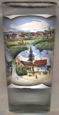
The present Protestant  church of Sankt Lambert [bottom centre picture, left]
was built in 1837. The only parts remaining from the medieval church are the lower parts of the tower. The tower was
heightened in 1901; the picture ist thus labeled Neuer Turm, 'new tower'.
church of Sankt Lambert [bottom centre picture, left]
was built in 1837. The only parts remaining from the medieval church are the lower parts of the tower. The tower was
heightened in 1901; the picture ist thus labeled Neuer Turm, 'new tower'.
The building to the right the church is labeled Altes
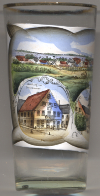
The bottom left picture on glass no. 0000 shows a view labeled
Handlung
[https://de.wikipedia.org/wiki/Hengstfeld, http://fallingrain.com/world/GM/01/Hengstfeld.html]
![[scale]](lineal.jpg)