
|
|
| ČESKÁ REPUBLIKA | CZECH REPUBLIC |
| Jihomoravský kraj | South Moravia (Brno) region |
| Okres: Blansko |
map →
 Sloup is situated at an elevation of 471 m at the confluence of the streams Žďárná
and Luha, about 6 km east of the district town Blansko and about 27 km northnortheast of the capital of the
Southmoravian region of the Czech Republic, Brno. The municipality has a population of about 960
(2019). While the official name of the municipality is Sloup (like several other places in the country), the name of
the cadastral area as well as of the Catholic parish is Sloup v Moravském krasu ('Sloup in the Moravian karst').
Sloup is situated at an elevation of 471 m at the confluence of the streams Žďárná
and Luha, about 6 km east of the district town Blansko and about 27 km northnortheast of the capital of the
Southmoravian region of the Czech Republic, Brno. The municipality has a population of about 960
(2019). While the official name of the municipality is Sloup (like several other places in the country), the name of
the cadastral area as well as of the Catholic parish is Sloup v Moravském krasu ('Sloup in the Moravian karst').
 Sloup was first mentioned in 1373. From 1763 until 1945 the domains were in possession of the counts (1790 princes)
Salm-Reifferscheidt-Raitz. Following the abolition of manorialism Sloup became a market town in 1862; this status
(městys) was renewed in 2007.
Sloup was first mentioned in 1373. From 1763 until 1945 the domains were in possession of the counts (1790 princes)
Salm-Reifferscheidt-Raitz. Following the abolition of manorialism Sloup became a market town in 1862; this status
(městys) was renewed in 2007.
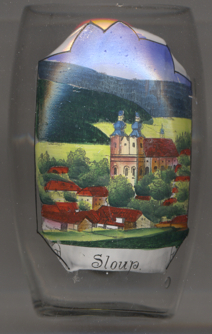
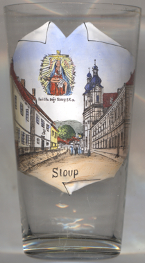
The  church of Our Lady of Sorrows [far left, no. 3905, and near left, no. 3920]
is a Marian pilgrimage site and the Roman Catholic parish church of Sloup. It was built in 751–1754 following the
miraculous healing of the daughter of a local miller and on the initiative of the counts of Rájec (Raitz) from the
Rogendorf family. The author of the architectural design was the architect Isidore Marcello Canavale, the construction
was supervised by the Boskovice builder Vavřinec Pavel Mertha.
church of Our Lady of Sorrows [far left, no. 3905, and near left, no. 3920]
is a Marian pilgrimage site and the Roman Catholic parish church of Sloup. It was built in 751–1754 following the
miraculous healing of the daughter of a local miller and on the initiative of the counts of Rájec (Raitz) from the
Rogendorf family. The author of the architectural design was the architect Isidore Marcello Canavale, the construction
was supervised by the Boskovice builder Vavřinec Pavel Mertha.
Another glass in this collection is from Sloup v Čechách.
[https://de.wikipedia.org/wiki/Sloup_v_Moravsk%C3%A9m_Krasu;
https://cs.wikipedia.org/wiki/Kostel_Panny_Marie_Bolestn%C3%A9_(Sloup)]
![[scale]](lineal.jpg)