
|
|
| ÖSTERREICH | AUSTRIA |
| Bundesland: Niederösterreich | Lower Austria |
| Bezirk: Hollabrunn |
map →

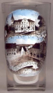
 The district town Hollabrunn is situated at an elevation of 236 m on the stream Göllersbach in the western Weinviertel region of Lower Austria.
The first mentioning in a document (Holerbrunen) dates from 1135. Hollabrunn superior or Oberhollabrunn was the official
name from 1288 until 1928, when it was changed to Hollabrunn. The rights of a market town were obtained prior to 1377.
Most parts of the town were destroyed during the Napoleonic Wars of 1805 and 1809 (the 'Battle of Hollabrunn and Schöngrabern' is mentioned in an inscription
on the Arc de Triomphe in Paris and in Leo Tolstoj's book 'War and Peace').
(Ober)Hollabrunn received the status of a town in 1908.
The district town Hollabrunn is situated at an elevation of 236 m on the stream Göllersbach in the western Weinviertel region of Lower Austria.
The first mentioning in a document (Holerbrunen) dates from 1135. Hollabrunn superior or Oberhollabrunn was the official
name from 1288 until 1928, when it was changed to Hollabrunn. The rights of a market town were obtained prior to 1377.
Most parts of the town were destroyed during the Napoleonic Wars of 1805 and 1809 (the 'Battle of Hollabrunn and Schöngrabern' is mentioned in an inscription
on the Arc de Triomphe in Paris and in Leo Tolstoj's book 'War and Peace').
(Ober)Hollabrunn received the status of a town in 1908.
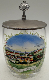
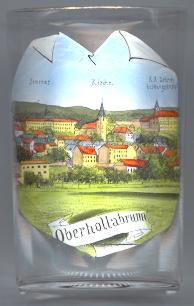
The  parish church Sankt Ulrich [near left, no. 4245: background, and below, no. 400: top left background; and right, no. 645: centre]
goes back to a Romanesque church of the 12th century. The parish was first mentioned in 1321. The Early Gothic chancel and crypt date from the 14h century.
The interior was remodelled in baroque style during the 17th century, and remodelled in Neo-Gothic style during the late 19th century.
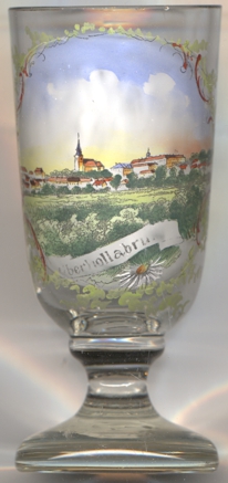
parish church Sankt Ulrich [near left, no. 4245: background, and below, no. 400: top left background; and right, no. 645: centre]
goes back to a Romanesque church of the 12th century. The parish was first mentioned in 1321. The Early Gothic chancel and crypt date from the 14h century.
The interior was remodelled in baroque style during the 17th century, and remodelled in Neo-Gothic style during the late 19th century.
![[scale]](lineal.jpg)