
|
|
| DEUTSCHLAND | GERMANY |
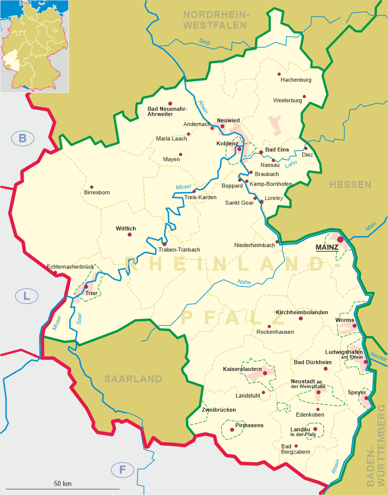
| Bundesland: Rheinland-Pfalz | Rhineland-Palatinate |
| Landkreis: Bernkastel-Wittlich |
map →
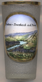 Traben-Trarbach is situated at an elevation of 110 m in the central Mosel valley, about 16 km southeast of the district town
Wittlich, and about 50 km west of the capital of Rhineland-Pfalz, Mainz. The municipality has a population of
about 5,600 (2020).
Traben-Trarbach is situated at an elevation of 110 m in the central Mosel valley, about 16 km southeast of the district town
Wittlich, and about 50 km west of the capital of Rhineland-Pfalz, Mainz. The municipality has a population of
about 5,600 (2020).
The Aacher Hof estate was first mentioned in AD 830 in a document confirming the donation of the village and surroundings to the minster of Aachen. In the 17th century, the town was part of what was then known as Rhenish Franconia, a strategic area fought over by France and the Holy Roman Empire. Seized by France in the 1683–1684 War of the Reunions, Traben was the location for the new fortress of Mont-Royal, constructed by Sébastian de Vauban, the leading military engineer of the period. The main ramparts were 30 metres high and three kilometres long, with space for 12,000 troops; despite the enormous cost, it was demolished when the French withdrew following the 1697 Treaty of Ryswick and only the lower foundations are visible today. In 1816, the area around Trarbach was annexed to Prussia, with Trarbach itself becoming the seat of a Bürgermeisterei ('Mayoralty'). Against expectations, however, Zell, rather than Trarbach, was made the district seat. In 1884, Trarbach lost its status of mayoralty and was adminitered in personal union by the neighburing community of Traben. The first bridge between the two cmmunities was built in 1898. In 1904, the municipality of Traben and the town of Trarbach merged to become the town of Traben-Trarbach. The neighbouring municipalities of Kautenbach and Wolf were incorporated into Traben-Trarbach in 1969. In 1970, Traben-Trarbach became the seat of a Verbandsgemeinde ('collective municipality') which also administers Bausendorf, Bengel, Burg, Diefenbach, Enkirch, Flußbach, Hontheim, Irmenach, Kinderbeuern, Kinheim, Kröv, Lötzbeuren, Reil, Starkenburg and Willwerscheid.
 The
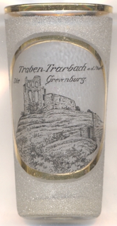
The  Grevenburg castle was the ancient residence of the Rear County of Sponheim and today is in ruins following its
destruction by the French in 1734. The castle was built in 1350 and replaced Castle Starkenburg as the residence of the Rear County of Sponheim.
With the extinction of the ruling male line of the Rhenish branch of the House of Sponheim in 1437 the castle became seat of the bailiff of the new
Counts to Sponheim (Baden and Palatinate-Simmern or Palatinate-Zweibrücken or
Palatinate-Birkenfeld). In 1680 it was conquered by France and was extended, together with the fort of Mont Royal in the horshoe bend of the Mosel north
of the town of Traben-Trarbach, as a part of the fortifications. During the War of the Spanish Succession (1701–1714), in 1702 it was again taken
by the French. However, in 1704 it was retake by the troops of the landgrave of Hesse-Kassel. The badly damaged castle was then
occupied by the Dutch. In 1730 it was repaired by the Electorate of Trier for the defence of Koblenz
and the Rhine river. In the War of the Polish Succession it was taken after three weeks' siege for the fourth and last time by the French who destroyed it
in 1734. Of the castle, although only the western wall of the former keep remains, the foundations are largely intact.
Grevenburg castle was the ancient residence of the Rear County of Sponheim and today is in ruins following its
destruction by the French in 1734. The castle was built in 1350 and replaced Castle Starkenburg as the residence of the Rear County of Sponheim.
With the extinction of the ruling male line of the Rhenish branch of the House of Sponheim in 1437 the castle became seat of the bailiff of the new
Counts to Sponheim (Baden and Palatinate-Simmern or Palatinate-Zweibrücken or
Palatinate-Birkenfeld). In 1680 it was conquered by France and was extended, together with the fort of Mont Royal in the horshoe bend of the Mosel north
of the town of Traben-Trarbach, as a part of the fortifications. During the War of the Spanish Succession (1701–1714), in 1702 it was again taken
by the French. However, in 1704 it was retake by the troops of the landgrave of Hesse-Kassel. The badly damaged castle was then
occupied by the Dutch. In 1730 it was repaired by the Electorate of Trier for the defence of Koblenz
and the Rhine river. In the War of the Polish Succession it was taken after three weeks' siege for the fourth and last time by the French who destroyed it
in 1734. Of the castle, although only the western wall of the former keep remains, the foundations are largely intact.
[https://de.wikipedia.org/wiki/Traben-Trarbach, https://en.wikipedia.org/wiki/Traben-Trarbach;
https://en.wikipedia.org/wiki/Grevenburg]
![[scale]](lineal.jpg)