
|
|
| DEUTSCHLAND | GERMANY |
| Bundesland: Rheinland-Pfalz | Rhineland-Palatinate |
| Landkreis: Vulkaneifel |
map →
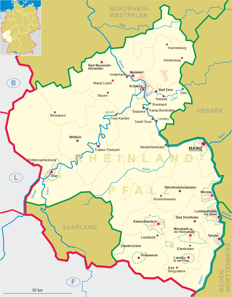
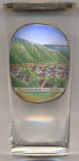 Birresborn is situated at an elevation of 340 m about 6 km south of Gerolstein in the district Vulkaneifel in the west of
Germany's state of Rheinland-Pfalz. The municipality has a population of about 1,100 (2020).
Birresborn is situated at an elevation of 340 m about 6 km south of Gerolstein in the district Vulkaneifel in the west of
Germany's state of Rheinland-Pfalz. The municipality has a population of about 1,100 (2020).
The oldest known written document that mentions Birgisburias in Carasco dates from 762 AD.
With the opening of the Eifel railway in 1871 (Gerolstein–Trier), Birresborn was connected to the German railway system.
The mineral spring 'Lindenquelle' was recognised as a charitable organisation. The mineral springs were finally recognised by the state in 1914.
A large part of the town was destroyed in 1944 during an Allied air raid. Following the adminsitrative reform in Rhineland-Palatine in 1970, Birresborn
and 14 other municipalities of the district Prüm, which was dissolved at the same time, were reassigned to the district Daun, which in 2007
was renamed district Vulkaneifel.
[https://de.wikipedia.org/wiki/Birresborn, https://en.wikipedia.org/wiki/Birresborn]
![[scale]](lineal.jpg)