
|
|
| POLSKA | POLAND |
| województwo: Dolnośląskie | voivodship: Lower Silesia |
| powiat: Oleśnica | county: Oleśnica |
map →
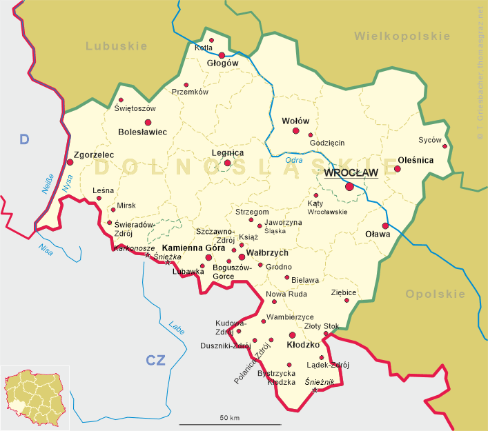
Syców is situated at an elevation of 153 m in the Wzgórza Trzebnickie (German: Katzengebirge, 'Cat Mountains') of Lower Silesia, about 25 km northeast of the district town Oleśnica and about 53 km northeast of the Lower Silesia's capital, Wrocław. The municipality has a population of about 10,300 (2020).
 The settlement was first mentioned under the Old Polish name Syczowe in a document issued in 1276, and soon after it also appeared
under the German name Wrathenberc. After the fragmentation of Poland in 1138, Syców was part of the Silesian duchies of
Glogów (from 1291) and Oleśnica (from 1312). It was granted town rights
before 1312. When the duchy of Oleśnica fell under Bohemian suzerainty in 1329, the town, however, remained under the rule of the
dukes of the Piast dynasty until 1489. In 1480 it fell under Hungarian suzerainty, but in 1490 became part of Jagiellonian-ruled Bohemia.
From 1684, a postal route connecting Warsaw and Wrocław ran through the town, and in the 18th century, one of two main routes
connecting Warsaw and Dresden also ran through the town. In 1734 it was acquired by Ernst Johann von Biron (from
1737 Duke of Courland), whose descendants held Wartenberg even after the Prussian annexation of Silesia in 1742, until they were expelled
in 1945. From 1871 to 1945 part of Germany, in 1888 the Germans changed the name of the town from Polnisch Wartenberg to
Groß Wartenberg to remove traces of Polish origin. After World War I, the Treaty of Versailles divided the county in half
between Germany and the restored Polish state, leaving the town itself in the former. It was eventually reintegrated with Poland after
World War II in 1945.
The settlement was first mentioned under the Old Polish name Syczowe in a document issued in 1276, and soon after it also appeared
under the German name Wrathenberc. After the fragmentation of Poland in 1138, Syców was part of the Silesian duchies of
Glogów (from 1291) and Oleśnica (from 1312). It was granted town rights
before 1312. When the duchy of Oleśnica fell under Bohemian suzerainty in 1329, the town, however, remained under the rule of the
dukes of the Piast dynasty until 1489. In 1480 it fell under Hungarian suzerainty, but in 1490 became part of Jagiellonian-ruled Bohemia.
From 1684, a postal route connecting Warsaw and Wrocław ran through the town, and in the 18th century, one of two main routes
connecting Warsaw and Dresden also ran through the town. In 1734 it was acquired by Ernst Johann von Biron (from
1737 Duke of Courland), whose descendants held Wartenberg even after the Prussian annexation of Silesia in 1742, until they were expelled
in 1945. From 1871 to 1945 part of Germany, in 1888 the Germans changed the name of the town from Polnisch Wartenberg to
Groß Wartenberg to remove traces of Polish origin. After World War I, the Treaty of Versailles divided the county in half
between Germany and the restored Polish state, leaving the town itself in the former. It was eventually reintegrated with Poland after
World War II in 1945.
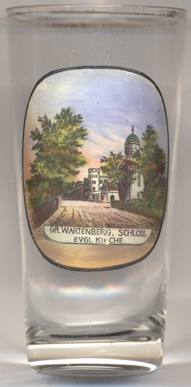
 Wartenberg castle [left, no. 4218: background] goes back to a castle built in this site
in the 12th century to secure a trade route from Wrocław to Toruń. From 1489 the place was
part of a free estate rule. A Baroque castle was built nearby between 1594 and 1608. After severe fire damage, a new Baroque palace was
built in 1721. This structure was destroyed again by fire in 1813. A new, neo-Gothic palace was built finally from 1853 by the architect
Carl Heinrich Wilhelm Wolff, the medieval castle was demolished in 1854. After the city was taken by the Red Army, the castle was plundered
and set on fire. Although the new Polish administration initially planned a reconstruction, the castle was demolished between 1951 and 1958.
Only a few buildings have been preserved.
Wartenberg castle [left, no. 4218: background] goes back to a castle built in this site
in the 12th century to secure a trade route from Wrocław to Toruń. From 1489 the place was
part of a free estate rule. A Baroque castle was built nearby between 1594 and 1608. After severe fire damage, a new Baroque palace was
built in 1721. This structure was destroyed again by fire in 1813. A new, neo-Gothic palace was built finally from 1853 by the architect
Carl Heinrich Wilhelm Wolff, the medieval castle was demolished in 1854. After the city was taken by the Red Army, the castle was plundered
and set on fire. Although the new Polish administration initially planned a reconstruction, the castle was demolished between 1951 and 1958.
Only a few buildings have been preserved.
The Protestant church [[left, no. 4218: right] was built in 1785–1789 in Classicist
style following a design of the architect Carl Gotthard Langhans as the castle church. In 1794 a clock was installed in the tower. The church
was included in the register of monuments in 1964.
[https://de.wikipedia.org/wiki/Syców, https://en.wikipedia.org/wiki/Syców;
https://de.wikipedia.org/wiki/Schloss_Gro%C3%9F_Wartenberg;
https://de.wikipedia.org/wiki/Evangelische_Kirche_(Syc%C3%B3w)]
![[scale]](lineal.jpg)