
|
|
| DEUTSCHLAND | GERMANY |
| Bundesland: Freistaat Bayern | Bavaria |
| Regierungsbezirk: Niederbayern | |
| Stadt: Straubing |
map →

Straubing is situated at an elevation of 322 m on the Danube, mainly on its south bank, in Lower Bavaria, about 40 km southeast of Regensburg, 50 km northeast of Landshut, and about 110 km northeast of Munich. The municipality has a population of about 47,900 (2021).
The area of Straubing has been continuously settled since the Neolithic period. Conquered by the Romans in 16–14 BC, it became known as Sorviodurum, which was important as a Roman military base. After the fall of the Roman Empire Straubing became a centre of settlement of the Bavarii. A new part of the town ('Neustadt') was founded in 1218. When in 1349 Bavaria was partitioned among the sons of Emperor Ludwig IV of the Wittelsbach dynasty, Straubing became the capital of Bavaria-Straubing. A century later, in 1425/1429, it was inherited by Bavaria-Munich. In 1545, Bavaria finally remained united. In the 16th century, Straubing was the center of the Reformation in Lower Bavaria, but the city eventually had to bow to the exclusive catholicity of the Duchy of Bavaria. After the Thirty Years' War (1618–1648), which had caused severe damages and umanitarian losses, Straubing thrived again from the end of the 17th century, when it was rebuilt in Baroque style. Large parts of the city, however, were destroyed again by a large fire in 1780. After the secularisation of the beginning 19th century, Straubing largely lost its importance as an administrative centre; however, it still remained an important regional trading centre. During Worls War II, in 1944/1945, again large parts of the city were destroyed by Allied bomb raids, althiugh luckily most of the historic buildings were spared. The neighbouring communities of Hornstorf, Kagers, Alburg and Ittling were incorporated into the municipality in 1972, parts of Unterzeitldorn followed in 1976.
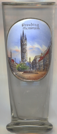
The  Stadtturm ('City Tower') [left, no. 4356: background centre] is the popular landmark of
Straubing. Construction started in 1316 and was completed first between 1379 and 1393. Further additions, especially additional floors, the tower dwelling
and the four characteristic corner turrets. were added until the 16th century. In order to ensure that the tower did not collapse, it was reinforced
with pillars already in the Gothic period. In the middle of the 17th century large cracks had surcaced, as a result of which the tower was fixed with
metal brackets in 1646, which still give it support. But even today the tower tilts to the south.
Stadtturm ('City Tower') [left, no. 4356: background centre] is the popular landmark of
Straubing. Construction started in 1316 and was completed first between 1379 and 1393. Further additions, especially additional floors, the tower dwelling
and the four characteristic corner turrets. were added until the 16th century. In order to ensure that the tower did not collapse, it was reinforced
with pillars already in the Gothic period. In the middle of the 17th century large cracks had surcaced, as a result of which the tower was fixed with
metal brackets in 1646, which still give it support. But even today the tower tilts to the south.
The Tiburtiusbrunnen (Tiburtius Fountain) [foreground] was created in 1685. The statue of St. Tiburtius
on top of it was renovated in 1955, the basin was remodeled in 1975.
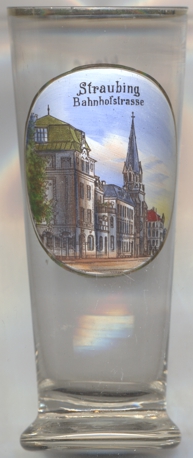
The Protestant Christuskirche [left, no. 4357: background] in Bahnhofstraße was built in
1887–1893. The church was destroyed on 18 April 1945 during an Allied bomb raid. A new church was constructed in 1955–1957.
[https://de.wikipedia.org/wiki/Straubing, https://en.wikipedia.org/wiki/Straubing;
https://de.wikipedia.org/wiki/Stadtturm_(Straubing);
https://de.wikipedia.org/wiki/Liste_der_Baudenkm%C3%A4ler_in_Straubing]
![[scale]](lineal.jpg)