
|
|
| DEUTSCHLAND | GERMANY |
| Bundesland: Hessen | Hesse |
| Kreis: Main-Kinzig-Kreis |
map →
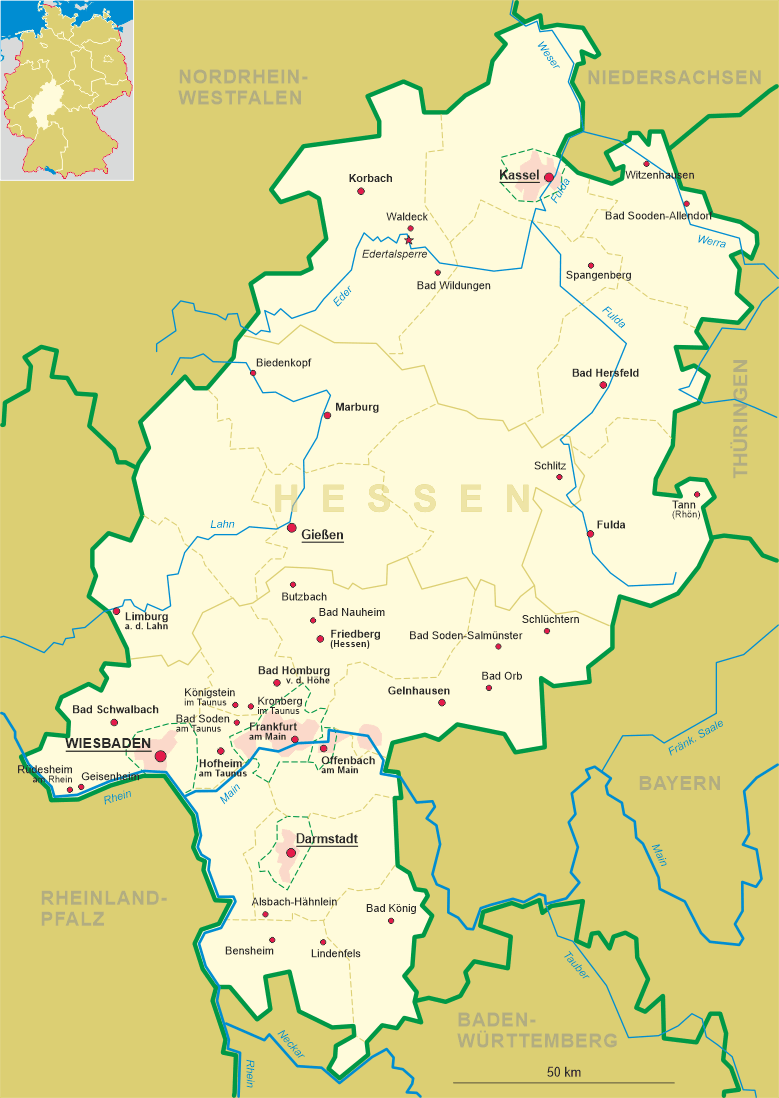
 Schlüchtern is situated at an elevation of 207 m in the east of the Main-Kinzig district, about 30 km
northwest of the district seat Gelnhausen, about 66 km northeast of Frankfurt am Main and
about 97 km northeast of Hesse's capital, Wiesbaden. The municipality has a population of about 15,900 (2021) and
includes the localities Ahlersbach, Breitenbach, Elm, Gundhelm, Herolz, Hohenzell, Hutten, Klosterhöfe, Kressenbach, Niederzell,
Schlüchtern (Innenstadt, Inner City), Vollmerz and Wallroth.
Schlüchtern is situated at an elevation of 207 m in the east of the Main-Kinzig district, about 30 km
northwest of the district seat Gelnhausen, about 66 km northeast of Frankfurt am Main and
about 97 km northeast of Hesse's capital, Wiesbaden. The municipality has a population of about 15,900 (2021) and
includes the localities Ahlersbach, Breitenbach, Elm, Gundhelm, Herolz, Hohenzell, Hutten, Klosterhöfe, Kressenbach, Niederzell,
Schlüchtern (Innenstadt, Inner City), Vollmerz and Wallroth.
There is evidence of a monastery settlement already existing around 750, a few years after the founding of the monastery of Fulda
in 744. The oldest surviving written mention is a document dating from 993. The place was originally imperial property, which was assigned to the monastery.
Later it was a fief of the Diocese of Würzburg to the Counts of Rieneck, who ceded it to Hanau in 1316 (County Hanau in
1458). The landlord was the abbot of the Schlüchtern monastery. The town was located on the "Via Regia" trade route from Frankfurt am Main to
Leipzig, which was important in the Middle Ages and early modern times. However, by the late Middle Ages the power of the
monastery was already waning. The Peasants' War and the Reformation accelerated its decline. The last (Protestant) abbot died in 1609. Today, the
abbey buildings continue to serve as a Gymnasium (school) and education facility for the regional Protestant church. With the death of the last Count of
Hanau in 1736, Schlüchtern together with the entire county of Hanau-Münzenberg fell to the Landgraviate of Hesse-Kassel,
from which the Electorate of Hesse arose in 1803. During the Napoleonic era, Schlüchtern was under French military administration from 1806, then
belonged to the Principality of Hanau from 1807 to 1810 and then to the Grand Duchy of Frankfurt from 1810 to 1813. It then fell back to the Electorate
of Hesse. After the administrative reform of the Electorate of Hesse in 1821, which divided Electoral Hesse into four provinces and 22 districts,
Schlüchtern became the administrative center of the Schlüchtern district of the same name. In 1866, after the Austro-Prussian War, the Electorate
was annexed by Prussia. After World War II it became part of the state of Hesse. Schlüchtern has been a recognized climatic health resort since
1966. The district Schlüchtern was dissolved in 1974 and was combined with the former districts of Hanau and Gelnhausen into the new
Main-Kinzig district.
[https://de.wikipedia.org/wiki/Schl%C3%BCchtern, https://en.wikipedia.org/wiki/Schl%C3%BCchtern]
![[scale]](lineal.jpg)