
|
|
| DEUTSCHLAND | GERMANY |
| Bundesland: Freistaat Bayern | Bavaria |
| Regierungsbezirk: Oberfranken | |
| Landkreis: Hof |
map →

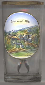 The Höllental ('Hell valley') is a protected nature reserve within the Franconian Forest in the district Hof.
The Selbitz River runs through this narrow valley and, at the end, marks the border between the states of Bavaria and Thuringia. From the end of
World War II until the reunification of Germany in 1989 the border here was closed. On the western banks of the Selbitz is the Höllentalstraße,
a private road that is closed to motor vehicles. It can however be used by cyclists and walkers. The valley has numerous walking trails. One of these
paths, the Röhrensteig east of the Selbitz, follows the course of the pressurised water pipes of an old electricity station, that today still uses
water from the Selbitz. It is dammed by a small weir. Points of interest include an outcrop of fossilised pillow lava on one of the steep sides of the
walk and the dolerite rock. There are several mineral springs near the village of Hölle at the entrance to the valley. The mineral water from these
springs is marketed under the name "Höllensprudel". The Marxgrün–Blankenstein railway, also known as the
Hell Valley railway or Höllentalbahn, used to run through the valley; it operated between 1901 and 1971.
The Höllental ('Hell valley') is a protected nature reserve within the Franconian Forest in the district Hof.
The Selbitz River runs through this narrow valley and, at the end, marks the border between the states of Bavaria and Thuringia. From the end of
World War II until the reunification of Germany in 1989 the border here was closed. On the western banks of the Selbitz is the Höllentalstraße,
a private road that is closed to motor vehicles. It can however be used by cyclists and walkers. The valley has numerous walking trails. One of these
paths, the Röhrensteig east of the Selbitz, follows the course of the pressurised water pipes of an old electricity station, that today still uses
water from the Selbitz. It is dammed by a small weir. Points of interest include an outcrop of fossilised pillow lava on one of the steep sides of the
walk and the dolerite rock. There are several mineral springs near the village of Hölle at the entrance to the valley. The mineral water from these
springs is marketed under the name "Höllensprudel". The Marxgrün–Blankenstein railway, also known as the
Hell Valley railway or Höllentalbahn, used to run through the valley; it operated between 1901 and 1971.
[https://de.wikipedia.org/wiki/H%C3%B6llental_(Frankenwald), https://en.wikipedia.org/wiki/H%C3%B6llental_(Franconian_Forest)]
![[scale]](lineal.jpg)