
|
|
| PORTUGAL | |
| distritos de Viana do Castelo, Braga, Vila Real |
map →
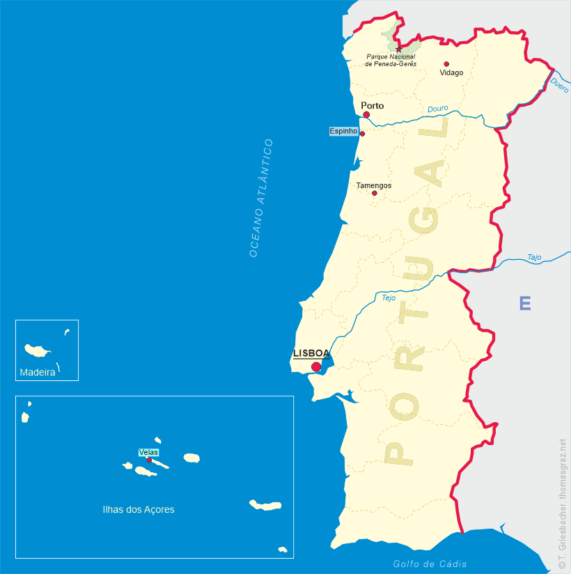
 Parque Nacional de Peneda-Gerês, also known simply as Gerês, is located in northern Portugal at the border to the Spanish
region and autonomous community of Galicia. Created in May 1971, it is the oldest protected area and the only national park in Portugal. It
covers an area of 695.9 km², occupying the districts of Viana do Castelo, Braga, and Vila Real and bordering the Spanish Baixa
Limia – Serra do Xurés natural park to the north, with which forms the UNESCO biosphere reserve of Gerês-Xurés.
Parque Nacional de Peneda-Gerês, also known simply as Gerês, is located in northern Portugal at the border to the Spanish
region and autonomous community of Galicia. Created in May 1971, it is the oldest protected area and the only national park in Portugal. It
covers an area of 695.9 km², occupying the districts of Viana do Castelo, Braga, and Vila Real and bordering the Spanish Baixa
Limia – Serra do Xurés natural park to the north, with which forms the UNESCO biosphere reserve of Gerês-Xurés.
Peneda-Gerês was given its name by its two main granite massifs, the Serra da Peneda and the Serra do Gerês which, with the Serra Amarela and the Serra do Soajo, constitute the park's highest peaks. On the other hand, the precipitous valleys, crossed by high flowing streams, host lush temperate broadleaf and mixed forests of oak and pine, being one of the last strongholds of the typical Atlantic European flora of Portugal, contrasting with an evolving Mediterranean biome. The park is also home to around 220 vertebrate species, some only native to the Iberian Peninsula.
The area now occupied by the park has had a long human history, reflected by its countless megalithic structures and Roman remains. Presently it is home to around 9,000 people scattered throughout small villages.
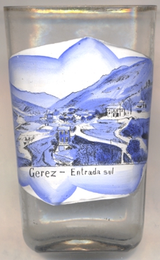
 The labeling on the front of glass no. 4422 is a mix of Spanish: Gerez (Gêres), and Portuguese: Entrada sul ('south entrance').
Glass no. 4422 is inscribed on the bottom with a name: Germano, the first and last letters of which can only be guessed.
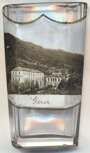
The  Grand Hotel Ribeiro [near left, no. 4582] was founded at the end of the 19th century by
António Joaquim Martins Ribeiro as the first hotel in Gerês.
Grand Hotel Ribeiro [near left, no. 4582] was founded at the end of the 19th century by
António Joaquim Martins Ribeiro as the first hotel in Gerês.
[https://en.wikipedia.org/wiki/Peneda-Ger%C3%AAs_National_Park;
https://turismo.cm-terrasdebouro.pt/geres-com-historia/]
![[scale]](lineal.jpg)