
|
|
| FRANCE | FRANCE |
| région: Grand Est | |
| département: 52, Haute-Marne |
map →
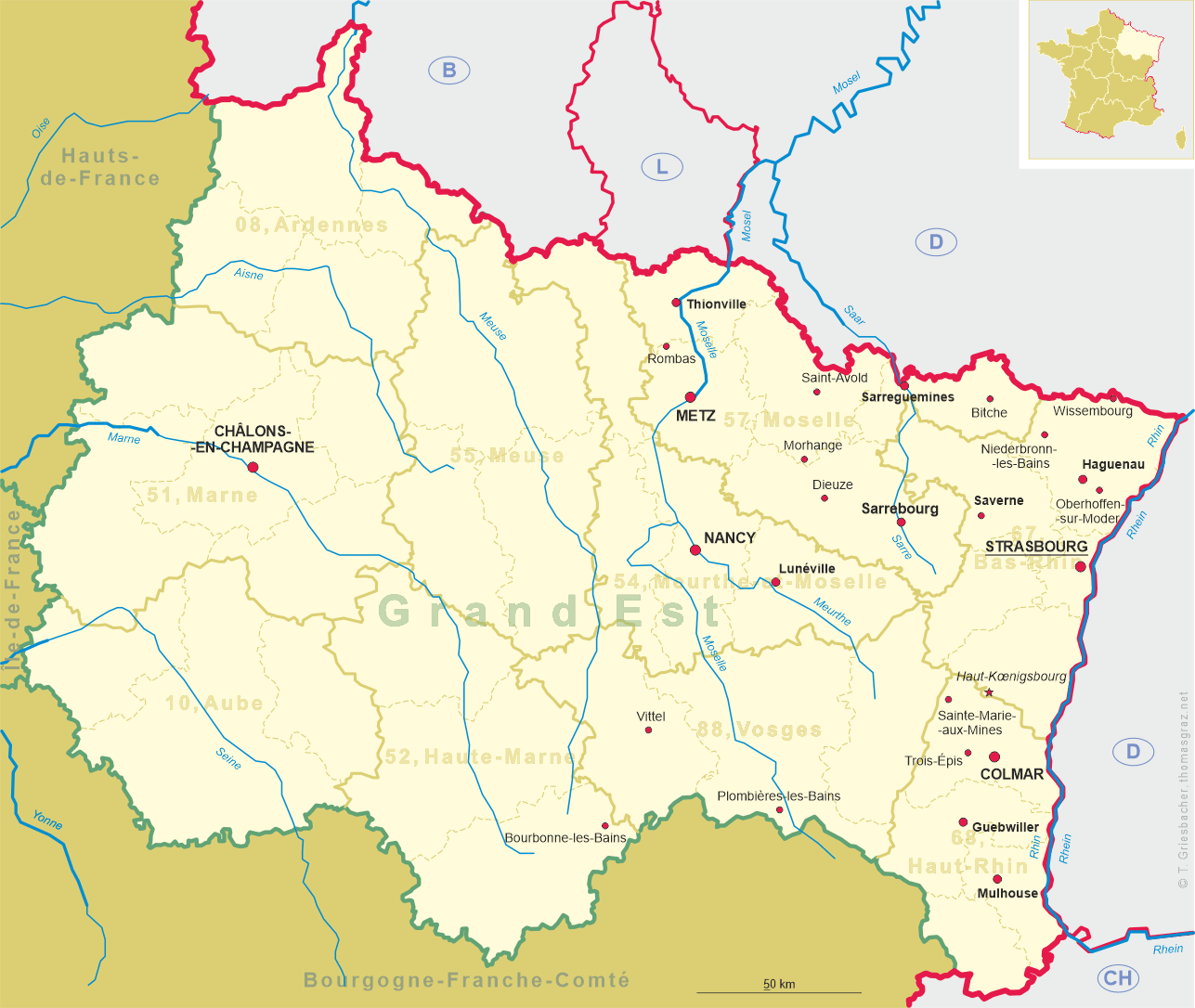
 Bourbonne-les-Bains is situataed at an elevation of 262 m on the river Apance in the southeast of the French département Haute-Marne,
in the canton Langres, about 33 km northeast of Langres and about 49 km southeast of the chef-lieu of the département, Chaumont, in the
région Grand Est of France, about 164 km southwest of Strasbourg, the region's capital. The municipality has a
population of about 2,000 (2020).
Bourbonne-les-Bains is situataed at an elevation of 262 m on the river Apance in the southeast of the French département Haute-Marne,
in the canton Langres, about 33 km northeast of Langres and about 49 km southeast of the chef-lieu of the département, Chaumont, in the
région Grand Est of France, about 164 km southwest of Strasbourg, the region's capital. The municipality has a
population of about 2,000 (2020).
The area was already inhabited in Celtic times, who already knew the thermal waters. In Roman times, the springs were known as Aquae Borvonis after the Celtic deity, Borvo. The Romans built the first thermal baths. From the 14th to the 17th centuries, the water provided the lords of Bourbonne with a rich income. The first documented mention of land and a church can be found in a deed of donation dated to AD 846. In 1717, a fire destroyed the city. A royal military hospital was opened in 1735 and a thermal bath in 1783. Bourbonne experienced a tourism boom, which increased with the advent of the railroad in the 19th century. Bourbonne-les-Bains historically belonged to the Bailliage de Langres within the province of Champagne. Since 1793 it is the chef-lieu of the canton of Bourbonne(-les-Bains). In 1972, the two previously independent communities of Genrupt and Villars-Saint-Marcellin were incorporated into the municipality.
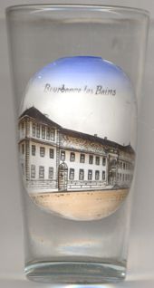
The  Établissement thermal (Grand bains civils) [left, no. 4505] was rebuilt in place of previous
structures in 1880–1883.
Établissement thermal (Grand bains civils) [left, no. 4505] was rebuilt in place of previous
structures in 1880–1883.
[http://fallingrain.com/world/FR/A4/BourbonnelesBains.html;
https://de.wikipedia.org/wiki/Bourbonne-les-Bains, https://en.wikipedia.org/wiki/Bourbonne-les-Bains;
https://bourbonne.com/hier-et-aujourdhui/historique-2/]
![[scale]](lineal.jpg)