
|
|
| DEUTSCHLAND | GERMANY |
| Bundesland: Sachsen-Anhalt | Saxony-Anhalt |
| Landkreis: Harz |
map →
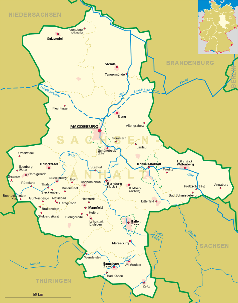
 Güntersberge is situated at an elevation of 412 m in the upper Selke valley in the Harz region in the west of Germany's state
of Saxony-Anhalt, about 11 km west of Harzgerode, about 28 km south-southwest of Halberstadt,
the administrative centre of the district Harz, and about 69 km southwest of Saxony-Anhalt's capital, Magdeburg.
As of 31 December 2019, Güntersberge has a population of 651. Since 2009 it its an urban district of the municipality of Harzgerode.
Güntersberge is situated at an elevation of 412 m in the upper Selke valley in the Harz region in the west of Germany's state
of Saxony-Anhalt, about 11 km west of Harzgerode, about 28 km south-southwest of Halberstadt,
the administrative centre of the district Harz, and about 69 km southwest of Saxony-Anhalt's capital, Magdeburg.
As of 31 December 2019, Güntersberge has a population of 651. Since 2009 it its an urban district of the municipality of Harzgerode.
Nearby Güntersburg castle was first mentioned in 1326, then located on important trade routes through the Harz mountains. The settlement of
Ghuntersberg itself was documented first in 1281, and in 1437 as a town. Temporarily given in pawn to the Landgraves of Thuringia and the
comital House of Stolberg, it was purchased in 1546 by the Ascanian prince George III of Anhalt-Plötzkau (until 1544
prince of Anhalt-Dessau). From 1603 the area belonged the Principality of Anhalt-Bernburg, from 1635
to 1709 to Anhalt-Harzgerode. Güntersberge remained part of the Free State of Anhalt until 1945. After World War II
the eastern Harz region was located in the Soviet occupation zone and became part of East Germany in 1949. From 1952 to 1990, it was part of the Bezirk
(district) Halle of the German Democratic Republic. Güntersberge was the site of a large summer camp run by the Ernst
Thälmann Pioneer Organisation. It has held the status of an officially recognized resort town since 2001. Güntersberge, together with the other
municipalities of the former Verwaltungsgemeinschaft (collective municipality) Unterharz, merged into the town of Harzgerode as of 1 August 2009.
[https://de.wikipedia.org/wiki/Stadt_G%C3%BCntersberge, https://en.wikipedia.org/wiki/G%C3%BCntersberge]
![[scale]](lineal.jpg)