
|
|
| ČESKÁ REPUBLIKA | CZECH REPUBLIC |
| Vysočina | Highlands (Jihlava) region |
| Okres: Havlíčkův Brod |
map →
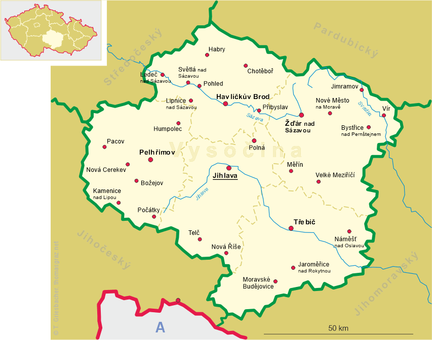
 Krucemburk (in German: Kreuzberg, from 1949 until 1993 in Czech: Křížová) is situated
at an elevation of 567 m on the right bank of the Doubrava in the western foothills of the Žďárské
vrchy (Saarer Berge, 'Žďár mountains'), which is part of the Bohemian-Moravian Highlands,
about 22 km northeast of the district town Havličkův Brod and about 38 km northeast of
the regional capital, Jihlava. The municipality has a population of about 1,600 (2023).
Krucemburk (in German: Kreuzberg, from 1949 until 1993 in Czech: Křížová) is situated
at an elevation of 567 m on the right bank of the Doubrava in the western foothills of the Žďárské
vrchy (Saarer Berge, 'Žďár mountains'), which is part of the Bohemian-Moravian Highlands,
about 22 km northeast of the district town Havličkův Brod and about 38 km northeast of
the regional capital, Jihlava. The municipality has a population of about 1,600 (2023).
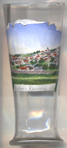
The town was likely founded as a mining town by the Teutonic Order in the beginning of the 13th century. The first documented mention
of Kreuzburk dates from 1241, when the town was granted mining rights for silver. Its name derives from lord of Kreuzburg,
who held the right to mint coins from 1247 to 1261. Over time, the Czech name Krucemburk developed from this, while the German name
changed to Kreuzberg. A church and a fortress were built as early as the 13th century. The town reached its heyday in the
15th and 16th centuries, but its importance declined during and after the Thirty Years' War (1618–1648). In 1670, the town received
the privilege of holding an annual market fair. After the abolition of the patrimonial rule at the end of the 19th century, Krucemburk
became an independent market town. In 1949, against the wishes of the residents, the town was renamed Křížová,
which sounded more Czech. In a referendum, the residents voted to return to the historical name Krucemburk, which the town has used
again since 1993. In November 2006, Krucemburk regained its status as a městys (market town), which it had lost in 1950.
[https://de.wikipedia.org/wiki/Krucemburk]
![[scale]](lineal.jpg)