
|
|
| ÖSTERREICH | AUSTRIA |
| Bundesland: Steiermark | Styria |
| Bezirk: Bruck-Mürzzuschlag |
map →

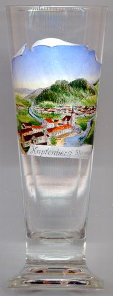
 Kapfenberg is situated at an elevation of 502 m on the river Mürz. It was first mentioned in a document of around 1144 (as Chaffenberch).
From the 15th century onward, hammer mills were located in Kapfenberg. The Böhler-Werke, the oldest steel industry of Central Europe, was founded here in 1864.
Kapfenberg obtained the status of a town in 1924. During World War II, large parts of the town were destroyed by the bomb raids in 1943–1945.
Kapfenberg is situated at an elevation of 502 m on the river Mürz. It was first mentioned in a document of around 1144 (as Chaffenberch).
From the 15th century onward, hammer mills were located in Kapfenberg. The Böhler-Werke, the oldest steel industry of Central Europe, was founded here in 1864.
Kapfenberg obtained the status of a town in 1924. During World War II, large parts of the town were destroyed by the bomb raids in 1943–1945.
The  parish church Sankt Oswald [left, no.933: centre], built in Late Gothic style, was first mentioned in 1330.
The church was enlarged in Baroque style in 1752–1755. The precious Rococo interior furnishing was added after 1770.
parish church Sankt Oswald [left, no.933: centre], built in Late Gothic style, was first mentioned in 1330.
The church was enlarged in Baroque style in 1752–1755. The precious Rococo interior furnishing was added after 1770.
![[scale]](lineal.jpg)