|
|
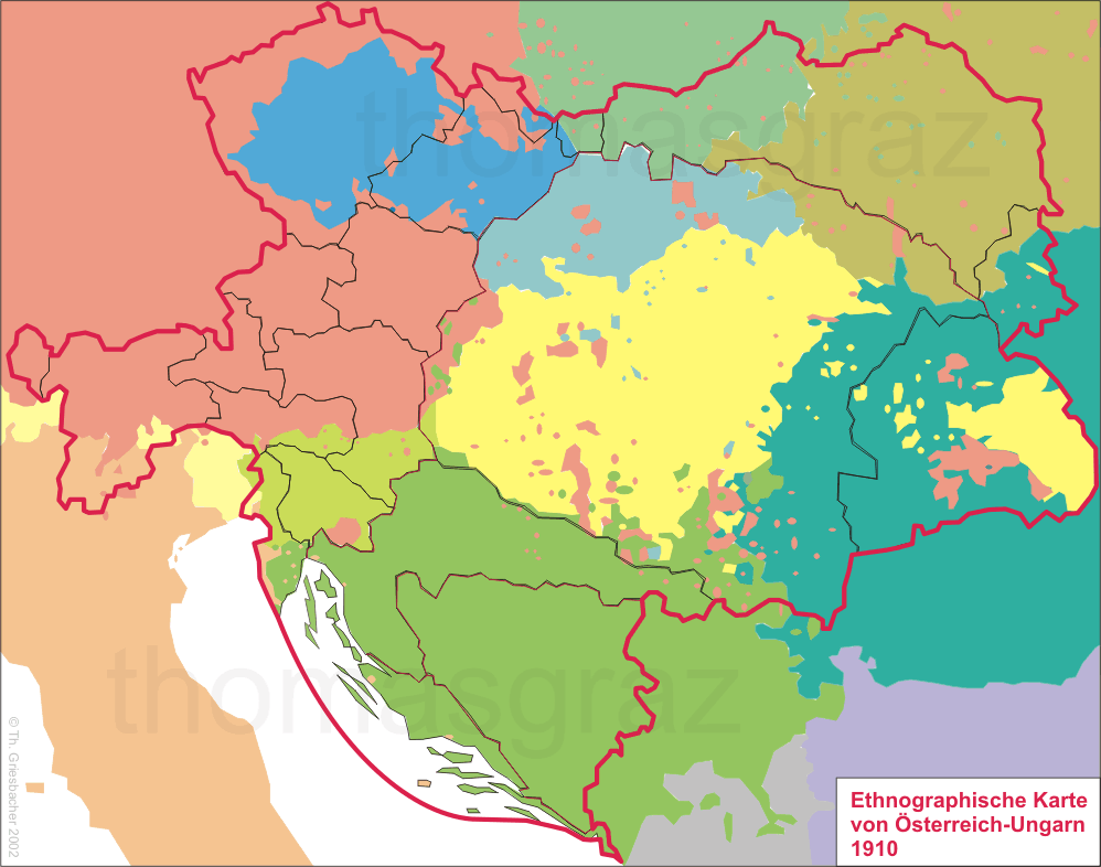
| Ethnographic map of the Austro-Hungarian Monarchy, 1910 |
The black and red lines show
the borders of the countries of the Austro-Hungarian Monarchy.
See also the political map of 1918 and the map of religions) of 1910.
| German 11,987,000 (24%) | Hungarian 10,051,000 (20%) | Slovene 1,253,000 (2%) | Croat, Serb 5,623,000 (11%) Czech | 6,436,000 (13%) Slovak | 1,946,000 (4%) Polish | 4,968,000 (10%) Ruthenian (Ukrainian) | 3,983,000 (8%) Italian | 768,000 (2%, incl. LAD, FRI) Ladin, Friulan
| Romanian | 3,223,000 (6%) TOTAL | 50,238,000 (100%) |