
|
|
| UNITED STATES OF AMERICA | |
| UTAH | |
| Salt Lake County |
map →
|
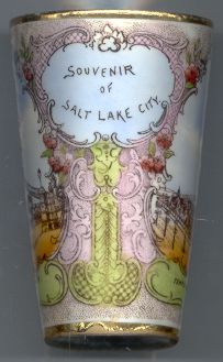
Salt Lake City is situated at an elevation of 4,294 ft (1,308 m) southeast of Great Salt Lake
at the north end of Salt Lake Valley. It is the capital of the state of Utah and is the seat of Salt Lake County.
As of the 2000 Census the city’s population was 181,743; the population of the metropolitan area including
Summit and Tooele counties is estimated at abuot 980,000.
Before Western settlement, the Shoshone, Ute, and Paiute had dwelled in the Salt Lake Valley for thousands of years. Great Salt Lake City was founded in 1847 by a group of Latter-day Saints (Mormons). Upon arrival their leader and religious prophet Brigham Young reportedly stated, “This is the right place.” It is thus one of the oldest cities of the region and still is the headquarters of The Church of Jesus Christ of Latter-day Saints. The newcomers organized a new state called Deseret and petitioned its recognition in 1849. The United States Congress rebuffed the settlers in 1850 and established the Utah Territory. Great Salt Lake City replaced Fillmore as the territorial capital in 1858, and the name was subsequently abbreviated to Salt Lake City. Disputes with the federal government ensued over widespread religious practice of polygamy. A climax occurred in 1857, with President James Buchanan declaring the area in rebellion when Brigham Young refused to step down as governor. The conflict called the Utah War began. The Latter-day Saints Church conceded in 1890, releasing “The Manifesto”, which officially renounced polygamy in the church. This paved the way for statehood in 1896, when Salt Lake City became the state capital. The First Transcontinental Railroad was completed in 1869 at Promontory Summit on the north side of the Great Salt Lake. A railroad was connected to the city from the Transcontinental Railroad in 1870 making travel less burdensome. Mass migration of different groups followed. Population growth began to stagnate during the 20th century with the advent of suburban life. As a result the suburban population greatly outnumbers the city proper itself. A major concern of recent government officials has been combating inner-city decay. The city lost population from the 1960s through the 1980s, but recovered in the 1990s. In 2002 Salt Lake City hosted the Olympic WInter Games. [Text adapted from http://en.wikipedia.org/wiki/Salt_Lake_City,_Utah]
|
| Temple Block is the traditional centre of Salt Lake City around Temple Square.
The
The [Text adapted from http://en.wikipedia.org/wiki/Salt_Lake_Temple, http://en.wikipedia.org/wiki/Salt_Lake_Tabernacle] 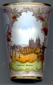
|
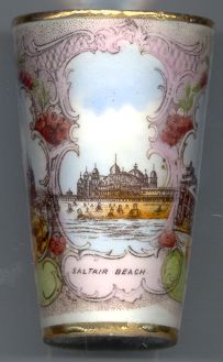
The first major calamity to strike Saltair came in 1910, when a windstorm wiped out the southern arc of bath houses. Rather than rebuild the bath houses, a huge entertainment and sports venue, the Hippodrome, was constructed. The resort did fairly well from 1910, through the World War I era (the railroad was electrified in 1917) and into the Roaring 20s. In April, 1925, a fire started in one of the concessions under the grandstands of the Hippodrome. In less than a day, everything but the roller coaster, bathhouses and concessions on the north end of the pier was reduced to ashes and blackened iron. The “newer, finer” Saltair opened in 1926 and enjoyed a efw years of high prosperity. The Great Depression was settling in as the 1930 season began. One year later, the lake receded behind the pavilion and left it in the middle of a mud flat. By 1933, the lake level was at a historic low that it would not see again until the late 1950s. Water’s edge was a half mile behind the pavilion. A small railroad pulled by an electric motor was built to take bathers from the pier to the lake. However, as the lake started to rise again, the tracks washed out. When the U.S. entered World War II, Saltair closed and did not reopen until 1946. In the 1950s the water of the lake was receding again; a dyke was built behind the pier and pumps were installed to move water back and forth between the lake and the swimming area. In 1958 Saltair closed and was donated to the state in the following year. In 1967 a fire destroyed most of the end of the pier leaving little more than the pavilion itself and one bathhouse. [Text adapted from http://www.geocities.com/gnav990 / Saltair_History_1893_1970.html?200519]
|
|
[Text adapted from http://www.planetware.com/salt-lake-city/eagle-gate-us-ut-eagle.htm, http://www.thingstodo.com/states/UT/salt_lake/eaglegate.htm] 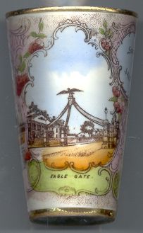
| |||||
![[scale]](lineal.jpg)
 Salt Lake Temple [right] is the sixth completed (of more than 100) and best-known temple of
The Church of Jesus Christ of Latter-day Saints. It is the sixth temple built by the church overall, and the fourth
operating temple built since the Mormon exodus from
Salt Lake Temple [right] is the sixth completed (of more than 100) and best-known temple of
The Church of Jesus Christ of Latter-day Saints. It is the sixth temple built by the church overall, and the fourth
operating temple built since the Mormon exodus from