
|
|
| ČESKÁ REPUBLIKA | CZECH REPUBLIC |
| Vysočina | Highlands (Jihlava) region |
| Okres: Žďár nad Sázavou |
map →
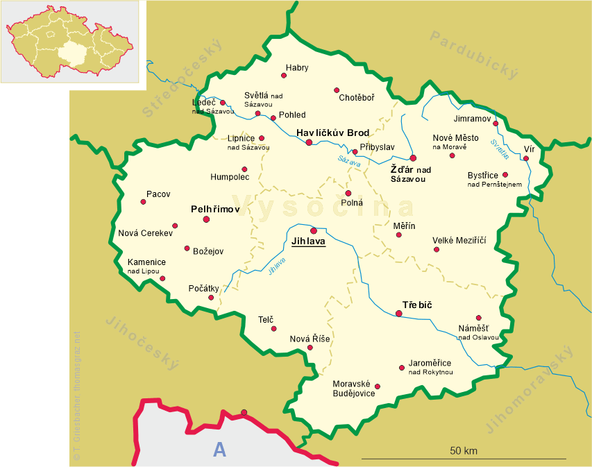
 Bystřice nad Pernštejnem is situated at an elevation of 533 m on the rivulet Bystřice
in the east of the district Žďár nad Sázavou of the Vysočina
region of the Czech Republic. The municipality has a population of about 8,100 (2019).
Bystřice nad Pernštejnem is situated at an elevation of 533 m on the rivulet Bystřice
in the east of the district Žďár nad Sázavou of the Vysočina
region of the Czech Republic. The municipality has a population of about 8,100 (2019).
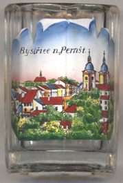
The settlement was established in the 13th century and was named after the rivulet where it is located. The oldest written document mentioning the place dates from 1298 (referring to an older, lost, document of 1238. In the 14th century it became the economic and commercial center of the surrounding villages in the Pernštejn dominion. In 1348 it obtained the status of a town and in 1580 it obtained further privileges. In 1905 the town was connected by railway with Žďár nad Sázavou and Tišnov which contributed to development of local industry. The town also benefited from the development of uranium industry in Dolní Rožínka. Since 1881 the official name of the town was Bistritz ob Pernstein (in German) and Bystřice nad Pernštýnem (in Czech); in 1925 the Czech name was changed to the present name, Bystřice nad Pernštejnem.
The  parish church of St. Lawrence [left, no. 3777: background right]
has a Gothic core of the 15th century. It was rebuilt in Baroque and Rococo style in 1750–1753 according to the project
of Ondřej Haupt. In 1841 the roofs burned down and were repaired in the second half of the 19th century.
parish church of St. Lawrence [left, no. 3777: background right]
has a Gothic core of the 15th century. It was rebuilt in Baroque and Rococo style in 1750–1753 according to the project
of Ondřej Haupt. In 1841 the roofs burned down and were repaired in the second half of the 19th century.
[https://de.wikipedia.org/wiki/Bystřice_nad_Pernštejnem, https://en.wikipedia.org/wiki/Bystřice_nad_Pernštejnem;
https://cs.wikipedia.org/wiki/Kostel_svatého_Vavřince_(Bystřice_nad_Pernštejnem)]
![[scale]](lineal.jpg)