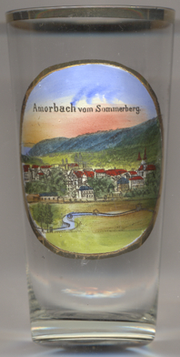

|
| DEUTSCHLAND | GERMANY |
| Bundesland: Freistaat Bayern | Bavaria |
| Regierungsbezirk: Unterfranken | |
| Landkreis: Amorbach |
 Amorbach is situated at an elevation of 165 m in the northeastern part of the Odenwald region in the district
Miltenberg. The municipality has a population of about 4,000 (2018).
The town began as a Benedictine monastery (Amorbach Abbey), which bit by bit grew into a settlement until in 1253 it was
raised to the status of a town. Over the years, the town changed hands several times. It was part of the Bishopric of
Würzburg until 1656, when it became part of the Archbishopric of Mainz.
As a result of the 1803 German Mediatisation (Reichsdeputationshauptschluss) the Archbishopric of Mainz was secularized, and
Amorbach became the residence town of the short-lived Principality of Leiningen. Only in 1816 did it become part of the
Kingdom of Bavaria. In 1965, Amorbach attained the status of climatic spa.
[https://de.wikipedia.org/wiki/Amorbach, https://en.wikipedia.org/wiki/Amorbach]
![[scale]](lineal.jpg)