
|
|
| ČESKÁ REPUBLIKA | CZECH REPUBLIC |
| Olomoucký kraj | Olomouc region |
| Okres: Jeseník |
map →
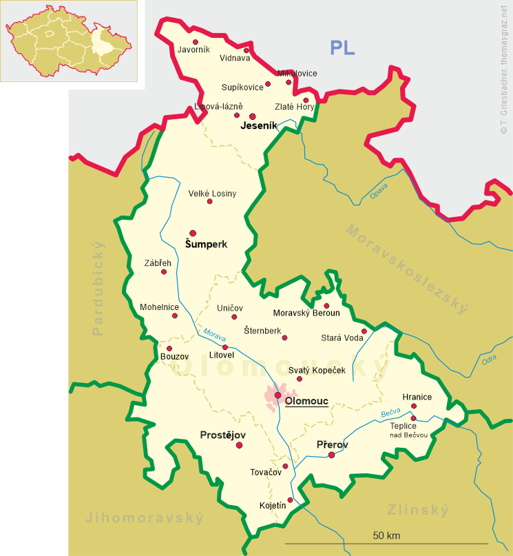
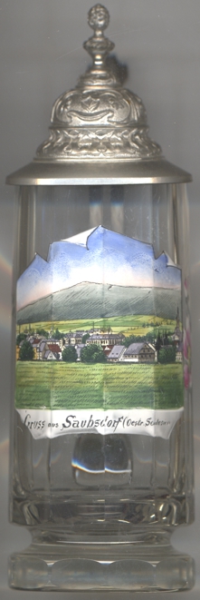
Supíkovice (German: Saubsdorf) is situated at an elevation of 407 m between the Rychlebské hory (Golden Mountains, Reichensteiner Gebirge) and the Zlatohorská vrchovina (Zlaté Hory Highlands, Zuckmanteler Bergland), about 10 km northeast of the district town Jeseník and about 79 km north of the regional capital Olomouc. The municipality has a population of about 669 (2021).
The first written mention of Supicovici is from 1284, when it was part of fragmented Piast-ruled Poland.
It soon became part of the Duchy of Nysa, which later on passed under Bohemian suzerainty, and following
the duchy's dissolution in 1850, it was incorporated directly into Bohemia. The municipality was in the past known for limestone quarries and
lime production. In the second half of the 19th century, the municipality became known for mining and processing of granite and marble.
Following World War I, from 1918, the municipality formed part of Czechoslovakia and from 1938 to 1945 it was occupied by Germany. During
World War II, the Germans operated the E166 and E577 forced labour subcamps of the Stalag VIII-B/344 prisoner-of-war camp for Allied POWs
in the village.
[https://de.wikipedia.org/wiki/Sup%C3%ADkovice, https://en.wikipedia.org/wiki/Sup%C3%ADkovice]
![[scale]](lineal.jpg)