
|
|
| DEUTSCHLAND | GERMANY |
| Bundesland: Niedersachsen | Lower Saxony |
| Landkreis: Göttingen |
map →
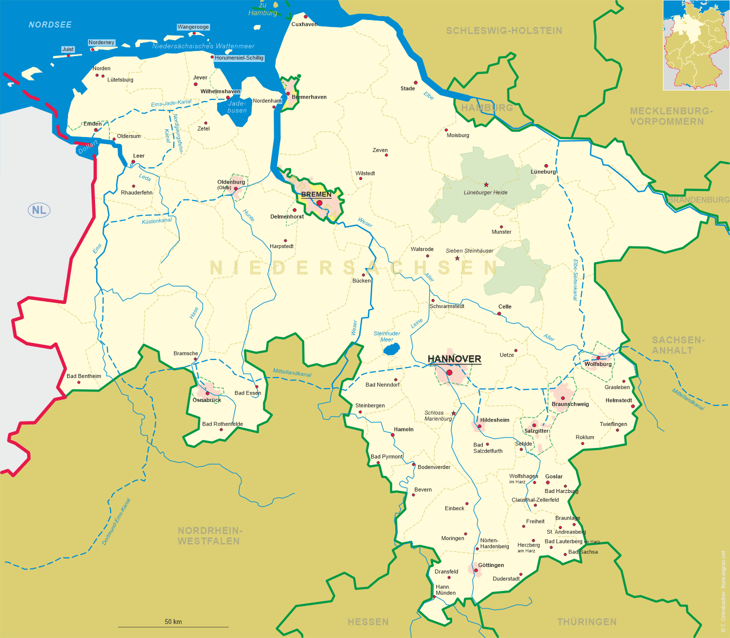
 Bad Lauterberg im Harz is situated at an elevation of 296 m in the southern foothills of the Upper Harz and is surrounded by mountains of the
Harz Nature Park, which reach up to 720 m above sea level in the Stöberhai area. The municipality has a population of about 10,300 (2023).
The district town Göttingen is located about 39 km to the southwest, Hannover, the capital of
Germany's state of Lower Saxony, lies 98 km to te northwest.
Bad Lauterberg im Harz is situated at an elevation of 296 m in the southern foothills of the Upper Harz and is surrounded by mountains of the
Harz Nature Park, which reach up to 720 m above sea level in the Stöberhai area. The municipality has a population of about 10,300 (2023).
The district town Göttingen is located about 39 km to the southwest, Hannover, the capital of
Germany's state of Lower Saxony, lies 98 km to te northwest.
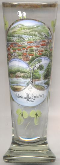
Lutterberg castle, first mentioned in 1190, was founded around 1180, but was completely destroyed in 1415. The county of Lutterberg was granted mining freedom
in 1521, which gave the miners there special rights. The village below the castle grew into a minig settlement, which in 1619 received permission to hold a
fair twice a year. During the Thirty Years' War (1618–1648) the place was destroyed completely in 1641. After the reconstruction, the copper smelter in
Luttertal was built in 1705 and the Königshütte ironworks was built in 1733. The latter was expanded in 1820 to include a foundry and a blast furnace.
The foundry remained in operation until 2001. Copper mining near Lauterberg ended between 1830 and 1868. The mining of barite continued until 2007. As early as
1839, it was recognised that there was a need for alternatives to mining and therefore a cold water sanatorium was created. The spa park was laid out in 1866
and was completed ten years later. Forty years later, the place was designated a spa by the
The
The lower right picture on glass no. 4563 shows a view of the
[https://de.wikipedia.org/wiki/Bad_Lauterberg_im_Harz;
https://de.wikipedia.org/wiki/Wiesenbeker_Teich]
 Wiesenbeker Teich (formerly also Aufrichtigkeiter Teich) [left, no. 4563: bottom left picture],
an artificial pond near Bad Lauterberg, was put into operation in 1715. It was once used to supply the impact water to the "Ehrlichkeit" copper mine in
Lauterberg. When ore mining stopped there, it supplied the Lauterberg Königshütte. The Wiesenbeker Pond and its structures have been placed under
monument protection. Since 2010 it has been a UNESCO World Heritage Site as part of the "Oberharzer Wasserregal" ('Upper Harz Water Shelf') under the name
"Bergwerk Rammelsberg, Altstadt von Goslar und Oberharzer Wasserwirtschaft" ('Rammelsberg Mine, Goslar Old Town and Upper Harz Water
Management').
(See also list of other UNESCO world heritage site places in this collection)
Wiesenbeker Teich (formerly also Aufrichtigkeiter Teich) [left, no. 4563: bottom left picture],
an artificial pond near Bad Lauterberg, was put into operation in 1715. It was once used to supply the impact water to the "Ehrlichkeit" copper mine in
Lauterberg. When ore mining stopped there, it supplied the Lauterberg Königshütte. The Wiesenbeker Pond and its structures have been placed under
monument protection. Since 2010 it has been a UNESCO World Heritage Site as part of the "Oberharzer Wasserregal" ('Upper Harz Water Shelf') under the name
"Bergwerk Rammelsberg, Altstadt von Goslar und Oberharzer Wasserwirtschaft" ('Rammelsberg Mine, Goslar Old Town and Upper Harz Water
Management').
(See also list of other UNESCO world heritage site places in this collection)
A note on the spelling used in the labeling of the glass: The pond here is identified as Wiesenbeecker Teich (with double e and 'ck');
while the spelling with 'ee' (Wiesenbeeker Teich) is common in documents and on postcards of the time, the spelling with 'ck' seems to be an error.
Kurpark
![[scale]](lineal.jpg) contact: webmaster
contact: webmaster