
|
|
| ROMÂNIA | ROMANIA |
| județ Timiș | Timiș County |
map →
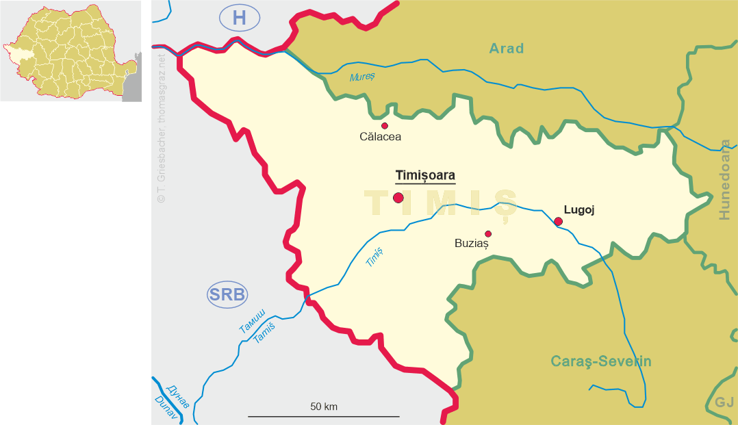
 Călacea is situated at an elevation of 115 m in the north of the Romanian Timiș district, about 23 km
north-northwest of the district capital Timișoara. As of 1 December 2021, the municipality had
a population of 662.
Călacea is situated at an elevation of 115 m in the north of the Romanian Timiș district, about 23 km
north-northwest of the district capital Timișoara. As of 1 December 2021, the municipality had
a population of 662.
The oldest known written mention of Kalandava dates from 1311; in 1341 it appeared as Kalacha, in 1454 as Kalocha. Starting with the Turkish period, Calacea is mentioned in the documents, Calazzo is recorded on the Josephinian land survey from 1717. After the Treaty of Passarowitz (Požarevac, 1718), when the Banat became a Habsburg crown domain, Kalatcs was part of the Banat of Temesvár. In 1920, after World War I and following the Treaty of Trianon, Banat was divided into three parts and the largest, eastern part, which includes Călacea, fell to the kingdom of Romania.
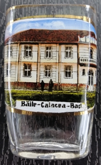
In 1905, a well was drilled with the intention of watering cattle, but instead, at a depth of 516 m the well produced not drinking water,
but thermal water at a temperature of 38°C. The first bathing facility with bathtubs was set up in 1912 and the facilities were extended
after World War I. Following World War II, the owners of the spa were expropriated in 1948 and the facilities were nationalised.
Subsequently, the spa facilities fell into disrepair until a private owner took them over in the 2000s.
[https://de.wikipedia.org/wiki/C%C4%83lacea_(Timi%C8%99);
https://www.fallingrain.com/world/RO/36/Calacea.html]
![[scale]](lineal.jpg)