
|
|
| ÖSTERREICH | AUSTRIA |
| Bundesland: Burgenland | |
| Bezirk: Oberwart |
map →
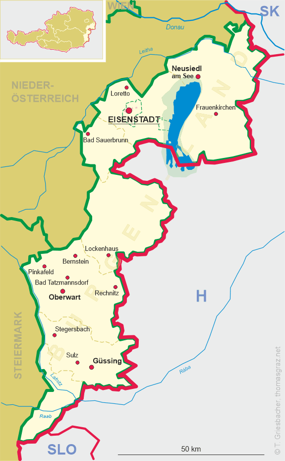
 Rechnitz is situated at an elevation of 366 m in the district Oberwart in the southern foothills of the Günser Gebirge
(Kőszeg Mountains), at the foot of the Geschriebenstein (884 m). The municipality has a population of about 3,100 (2009).
Rechnitz is situated at an elevation of 366 m in the district Oberwart in the southern foothills of the Günser Gebirge
(Kőszeg Mountains), at the foot of the Geschriebenstein (884 m). The municipality has a population of about 3,100 (2009).
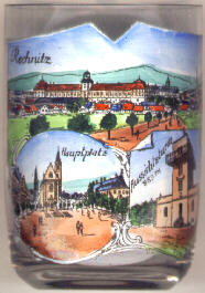
The  castle of Rechnitz [top]
was built by Adam Count Batthyány soon after he acquired the dominion in 1648.
It was completed in the 18th century. The castle was destroyed completely in 1945.
castle of Rechnitz [top]
was built by Adam Count Batthyány soon after he acquired the dominion in 1648.
It was completed in the 18th century. The castle was destroyed completely in 1945.
The parish church St. Katharina [bottom left]
was donated by Adam Batthyány and was finished in 1679. A small transept was added in 1850
(although much larger plans had originally been made for the enlargement of the church).
The lookout [bottom right]
on the summit of the Geschriebenstein was erected in 1913.
The Geschriebenstein (883 m) is the highest mountain of Burgenland and also of western Hungary.
Since 1921, when Burgenland joined Austria following a referendum,
the border between the two countries runs right through the middle of the tower.
![[scale]](lineal.jpg)