
|
|
| DEUTSCHLAND | GERMANY |
| Bundesland: Rheinland-Pfalz | Rhineland-Palatinate |
| Landkreis: Bernkastel-Wittlich |
map →
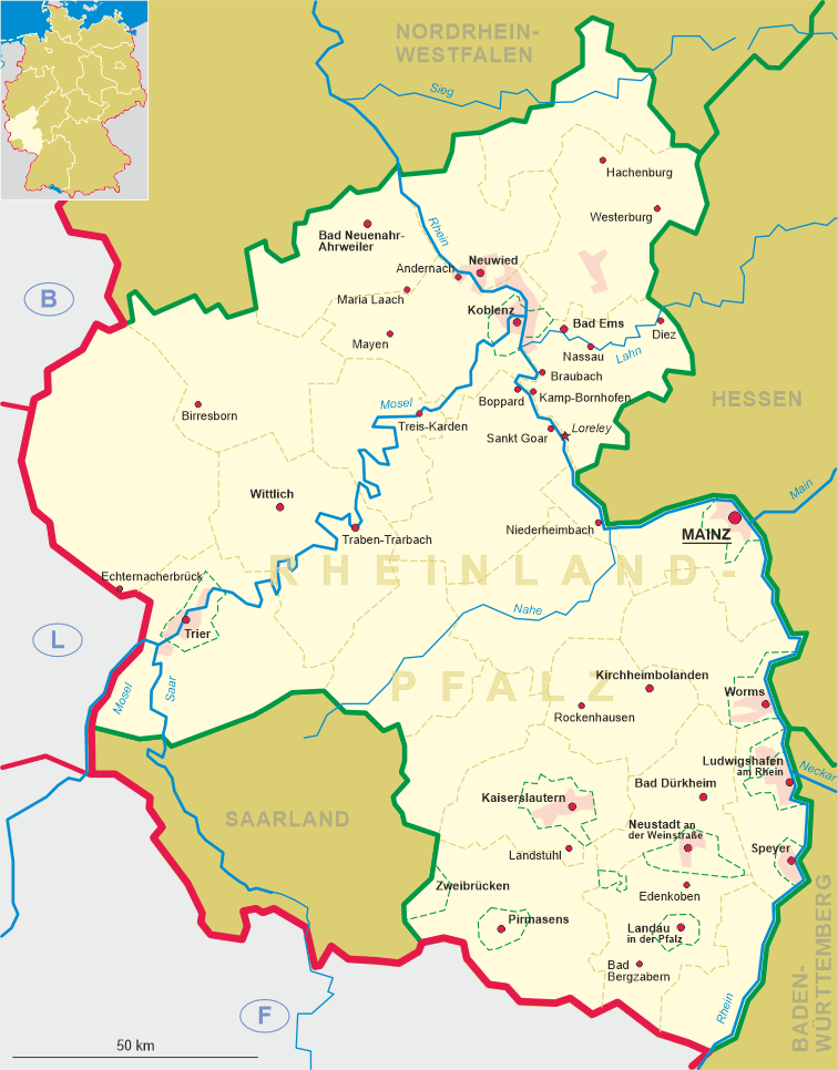
 Wittlich is situated at an elevation of 177 m on the river Lieser in the southern part of the Eifel hill region of western Rhineland-Palatinate.
Wittlich is the administrative seat of the district Bernkastel-Wittlich and has a population of about 19,000 (2005).
Wittlich is situated at an elevation of 177 m on the river Lieser in the southern part of the Eifel hill region of western Rhineland-Palatinate.
Wittlich is the administrative seat of the district Bernkastel-Wittlich and has a population of about 19,000 (2005).
The earliest traces of human settlements in this area date back to about 3000 BC. During the Roman period a villa was built here in the second half of the 2nd century AD. With its dimensions of about 140 by 28 m it is one of the largest of its kind north of the Alps. The villa was destroyed by invading Germanic tribes around 350 AD. Parts of it have been excavated and restored today. In the first third of the 7th century the area including the villa witelira came in possession of the bishopric of Trier. It remained a part of the Electorate Trier until 1794. The oldest document mentioning Wittlich itself dates from 1065. The earliest mention of the place as a market town dates from around 1220. In 1300 Wittlich was finally chartered as a town. In 1794 Wittlich was occupied by French troops and in 1801 was incorporated into the new département de la Sarre with Trier (Trèves) as its capital. Wittlich itself became the administrative seat of the canton of the same name within the département. After the Congress of Vienna of 1815 Wittlich became part of Prussia. A new town charter according to the statutes of the Prussian Rhine Province was granted in 1857. The neighbouring communities of Bombogen, Dorf, Lüxem, Neuerburg and Wengerohr were incorporated into Wittlich in 1969.
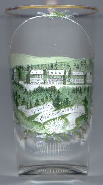
The picture on glass no. 2060 [left] shows a building labeled
 Heilanstalt (sanatorium) Grünewald.
![[scale]](lineal.jpg) contact: webmaster
contact: webmaster