
|
|
| DEUTSCHLAND | GERMANY |
| Bundesland: Sachsen-Anhalt | Saxony-Anhalt |
| Landkreis: Stendal |
map →
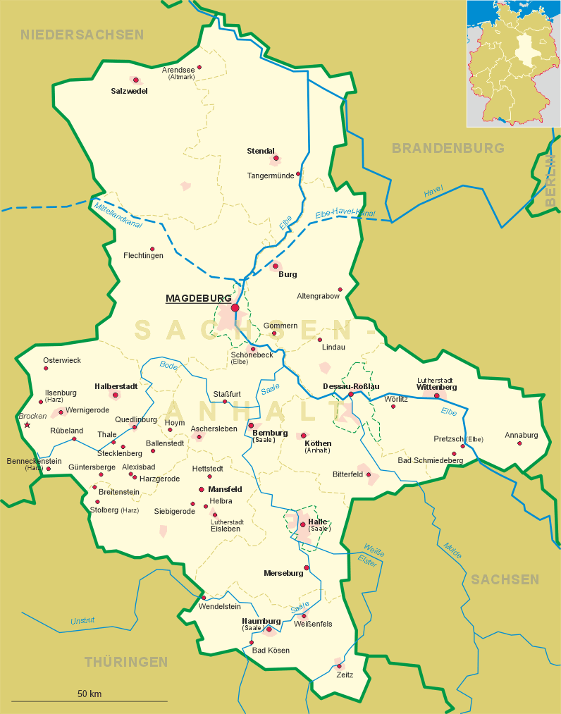
 Stendal is situated at an elevation of 31 m west of the river Elbe in the Altmark region of northern Saxony-Anhalt.
The city has a population of about 37,500 (2005) is the seat of the administration of the district of the same name.
Stendal is situated at an elevation of 31 m west of the river Elbe in the Altmark region of northern Saxony-Anhalt.
The city has a population of about 37,500 (2005) is the seat of the administration of the district of the same name.
The oldest written mention of the village Steinedal is found in a document of 1022, when it was in possession of the monastery of St. Michael in Hildesheim. In 1160 it obtained the privileges of a market town. The seafarer's guild of Stendal was founded in the 13th century and in 1300 the town was fortified. The oldest mention of Stendal as member of the Hanse federation of trading towns dates from 1350. However, in 1582, the city left the Hanse together with Berlin, Brandenburg an der Havel, Frankfurt (Oder) and Salzwedel. In 1640 Stendal became a garrison town and remained so for more than 300 years until 1994, when the Russian troops lefts. Between 1771 and 1830 large parts of the old fortifications were pulled down. The railroad between Magdeburg, Stendal and Wittenberge was opened in 1849. In May 2008, the prefix Hansestadt was again included in the official name of the city.
The famous archaeologist and art historian Johann Joachim Winckelmann (1717–1768) was born in Stendal.
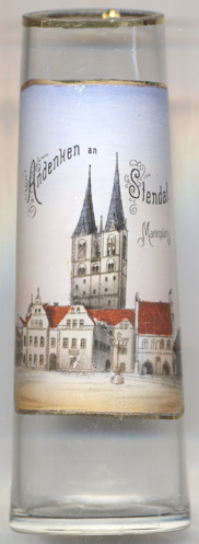
The  church Sankt Marien [background] was first mentioned in 1283.
The nave and choir were completed between after 1400 and 1447.
church Sankt Marien [background] was first mentioned in 1283.
The nave and choir were completed between after 1400 and 1447.
The town hall [foreground] was built in the 15th century. The famous
carved paneling in the ceremonial hall was created in 1462.
![[scale]](lineal.jpg)