
|
|
| DEUTSCHLAND | GERMANY |
| Bundesland: Saarland | |
| Stadtverband: Saarbrücken |
map →
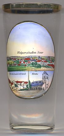 Walpershofen is situated at an elevation of 247 m in the Köllerbach valley, about 15 km northwest of Saarbrücken
in Germany's state of Saarland. Walpershofen is part of the municipality of Riegelsberg.
Walpershofen is situated at an elevation of 247 m in the Köllerbach valley, about 15 km northwest of Saarbrücken
in Germany's state of Saarland. Walpershofen is part of the municipality of Riegelsberg.
The earliest written mention of Walpershofen appears in a document of 1293. The history of coal mining in the Köller valley can be traced back to the 15th century. However, for centuries, farming was the main source of income and it was not until the mid-19th century, that mining became a major economical factor for the local communities. This came about when the coal deposits of the area were developed by the Prussian mining authorities. The Von der Heydt mine was opened in 1852. Due to the industrial revolution, both Walpershofen and Riegelsberg rapidly grew in size. On 19 January 1973, Walpershofen was incorporated into the municipality of Riegelsberg.
The bottom left picture on glass no. 2211 shows a view of the street
 Herchenbacher
The bottom right picture shows a view of the
Protestant
![[scale]](lineal.jpg)