
|
|
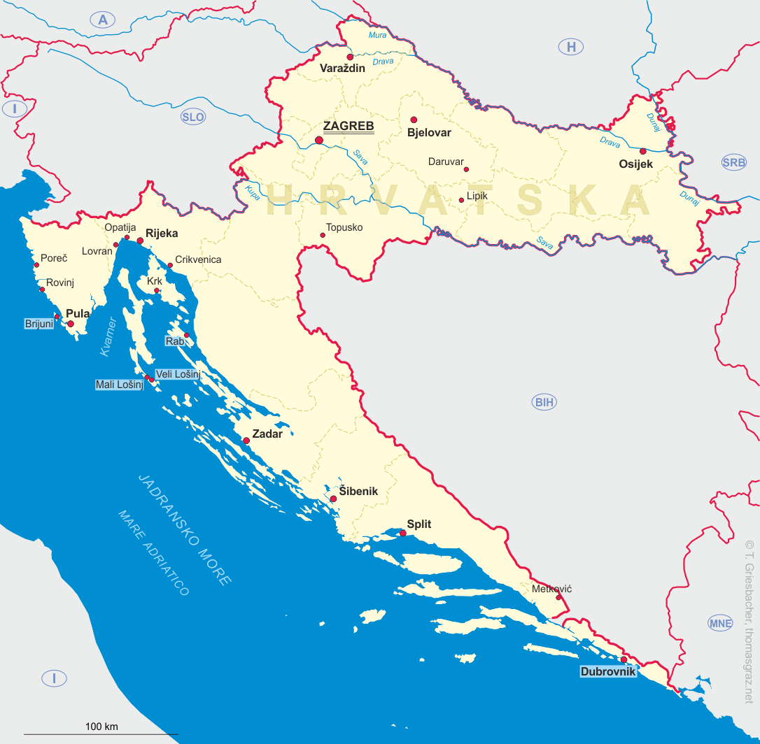
| HRVATSKA | CROATIA |
| županija: Varaždinska |
map →
Varaždin is situated at an elevation of 173 m on the left bank of the river Drava in the north of Croatia. Varaždin is the capital of the Varaždin county and has a population of about 49,000 (2001).
The first written reference to Varaždin was in 1181, when Béla III, King of Hungary, mentioned
the nearby thermal springs (Varaždinske Toplice) in a legal document. Varaždin was declared a free royal
borough in 1209 by King András (Endre) II. The town became the economic and military centre of northern Croatia.
Due to Turkish raids, the town was structured defensively around the old fortress. In the early 13th century, the
Knights Hospitaller came to Varaždin, where they built a church and a monastery. At the end of the 14th century
the Varaždin fortress passed into the hands of the counts of Celje. Over the following
centuries Varaždin had several owners, the most influential being Beatrice Frankopan and her husband Margrave
Georg ('the Pious') of Brandenburg-Ansbach. At the end of the 16th century the counts Erdödy became its owner, assuming the hereditary
position of Varaždin prefects (župan), and the fortress remained in the ownership of the Erdödy family until 1925.
 The periods of the Reformation and the Counter-reformation had a great influence on the Varaždin. With the arrival
of the Jesuits, the school (gymnasium) and the convent were founded, and churches and monasteries were built in splendid
Baroque style. In 1756, the Ban Franjo (Ferenc) Nádasdy chose Varaždin as his official residence, and Varaždin became
the capital of Croatia. It hosted the Sabor (the Croatian parliament) and the Royal Croatian Council founded by
Maria Theresia of Austria. However, the fire of 1776 destroyed most of the town, resulting in the administrative institutions moving
back to Zagreb. By the 19th century Varaždin had been completely rebuilt and expanded, with
flourishing crafts and trade, and later the manufacture of silk and bricks. In the 20th century Varaždin developed
into the industrial centre of Northern Croatia.
[https://en.wikipedia.org/wiki/Varaždin]
The periods of the Reformation and the Counter-reformation had a great influence on the Varaždin. With the arrival
of the Jesuits, the school (gymnasium) and the convent were founded, and churches and monasteries were built in splendid
Baroque style. In 1756, the Ban Franjo (Ferenc) Nádasdy chose Varaždin as his official residence, and Varaždin became
the capital of Croatia. It hosted the Sabor (the Croatian parliament) and the Royal Croatian Council founded by
Maria Theresia of Austria. However, the fire of 1776 destroyed most of the town, resulting in the administrative institutions moving
back to Zagreb. By the 19th century Varaždin had been completely rebuilt and expanded, with
flourishing crafts and trade, and later the manufacture of silk and bricks. In the 20th century Varaždin developed
into the industrial centre of Northern Croatia.
[https://en.wikipedia.org/wiki/Varaždin]
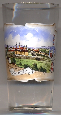
 Varaždin castle [left, no. 2909: foreground]
was first mentioned in 1181 under the name Garestin in a document of the Hungarian king Béla III.
It originally served as a fortress protecting the trading routes in this place. In the 16th century it was located within the
Military Border and served as one of the main fortifications protecting the Habsburg countries against the Ottoman Empire.
It was during this period that the castle was extended to its present shape with moats, ramparts and bastions.
In later periods, the castle was remodeled several times under various owners, amongst them the counts of Celje.
Towards the end of the 16th century the castle came in possession of the counts Erdődy who owned it until 1925 when the family
was dispossessed by the City of Varaždin. Today, the castle is home of the Varaždin municipal museum.
[https://de.wikipedia.org/wiki/Schloss_Varaždin]
Varaždin castle [left, no. 2909: foreground]
was first mentioned in 1181 under the name Garestin in a document of the Hungarian king Béla III.
It originally served as a fortress protecting the trading routes in this place. In the 16th century it was located within the
Military Border and served as one of the main fortifications protecting the Habsburg countries against the Ottoman Empire.
It was during this period that the castle was extended to its present shape with moats, ramparts and bastions.
In later periods, the castle was remodeled several times under various owners, amongst them the counts of Celje.
Towards the end of the 16th century the castle came in possession of the counts Erdődy who owned it until 1925 when the family
was dispossessed by the City of Varaždin. Today, the castle is home of the Varaždin municipal museum.
[https://de.wikipedia.org/wiki/Schloss_Varaždin]
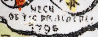
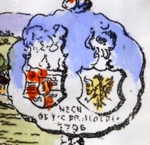 The picture on glass no. 2909 also shows 2 coat of arms [see detailed view, left]:
on the left, the coat of arms of Varaždin County or of the counts Erdődy (which are identical);
The coat of arms on the right could not yet be identified. The labeling below is illegible but includes the date 1796.
The picture on glass no. 2909 also shows 2 coat of arms [see detailed view, left]:
on the left, the coat of arms of Varaždin County or of the counts Erdődy (which are identical);
The coat of arms on the right could not yet be identified. The labeling below is illegible but includes the date 1796.
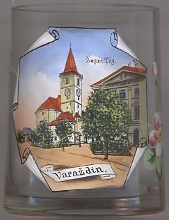
Glass no. 2241 [left] shows a view of
Župni parish
![[scale]](lineal.jpg)