
|
|
| DEUTSCHLAND | GERMANY |
| Bundesland: Sachsen-Anhalt | Saxony-Anhalt |
| Landkreis: Mansfeld-Südharz |
map →
Hettstedt is situated at an elevation of 200 m on the river Wipper at the northeastern edge of the Mansfeld basin, about 40 km northwest of Halle and about 50 km south of Saxony-Anhalt's capital, Magdeburg. The municipality has a population of about 15,400 (2006) and apart from Hettstedt proper also includes the villages of Ritterode and Walbeck (see below).
The earliest written mention of Heiczstete is found in a document of 1046, a deed of donation issued by Emperor Heinrich III
for the bishopric of Meißen. According to a popular legend, deposits of copper and silver were discovered here in 1199,
which initiated a first flourishing period of the settlement. In 1334 Hettstedt was chartered as a town. In 1394 the lord of
Halberstadt pawned the town to the counts of Mansfeld. In 1439 the town was besieged by the counts and thereafter
was incoporated into their county. In the 16th century the economic situation deteriorated considerably after the imports of silver
from the Spanish colonies in South America caused a deterioration of the silver prices. In 1573 the town had to be handed back under the
overlordship of Saxony, although mining still remained under control of the counts of Mansfeld. During the Thirty Years' War
(1618–1648) the population was reduced to about one third of the original number, and only about 11 houses remained habitable.
In the 17th century mining activities were again taken up, although this time mining for copper was more profitable.
After the death of the last count of Mansfeld-Vorderort-Bornstedt the mines in 1790 came under control of Prussia, while
Saxony regained control over the town of Hettstedt. After the introduction of steam engines in 1785 the mining activities were
expanded considerably. After the Napoleonic Wars and the Congress of Vienna (1815) the town became part of
Prussia (province Saxony). During the followig century, Hettstedt became a centre of heavy industry. After the Great Depression of 1929
copper mining was no longer profitable but was kept up with state subsidies during the Weimar Republic, the Third Reich and even
in the German Democratic Republic. In 1950 the neighbouring communities of Burgörner and Molmeck were incorporated into the municipality.
 In 1952 Hettstedt became the administrative seat of the newly formed district Hettstedt. Between 1951 and 1969 the ore deposits
were practicably exhausted and the mining activities were relocated to Sangerhausen, while the heavy industry remained in Hettstedt.
After the reunification of Germany in 1990, state subsidies were discontinued and mining was stopped. Asmost of the industrial facilities
were also mostly outdated, most of the factories were closed. Since then, Hettstedt is notorious for still having one of the highest
nemployment rates in Germany. In 1994 the districts Mansfeld and Eisleben were merged to become
the district Mansfelder Land which itself was merged in 2007 with the district Sangerhausen to become the present district Mansfeld-Südharz.
In 1952 Hettstedt became the administrative seat of the newly formed district Hettstedt. Between 1951 and 1969 the ore deposits
were practicably exhausted and the mining activities were relocated to Sangerhausen, while the heavy industry remained in Hettstedt.
After the reunification of Germany in 1990, state subsidies were discontinued and mining was stopped. Asmost of the industrial facilities
were also mostly outdated, most of the factories were closed. Since then, Hettstedt is notorious for still having one of the highest
nemployment rates in Germany. In 1994 the districts Mansfeld and Eisleben were merged to become
the district Mansfelder Land which itself was merged in 2007 with the district Sangerhausen to become the present district Mansfeld-Südharz.
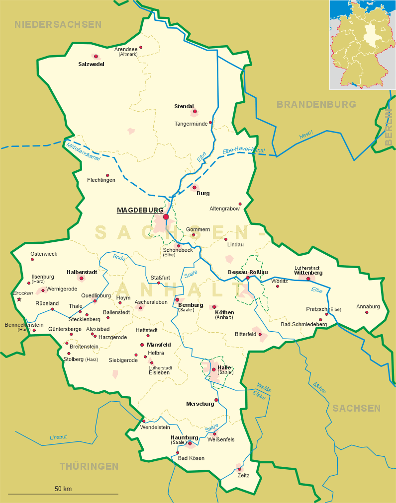
The  church of St. James (Sankt-Jacobi-Kirche) [left]
is Hettstedt's second church. A first church was already mentioned here in 1223. The present church was begun in 1418.
The choir was completed in 1429, the nave was finished in 1445. The tower was started in 1428 and was completed in 1475.
The vaulting of the nave was only finished in 1517. After a fire in 1697 the church was restored until 1706.
church of St. James (Sankt-Jacobi-Kirche) [left]
is Hettstedt's second church. A first church was already mentioned here in 1223. The present church was begun in 1418.
The choir was completed in 1429, the nave was finished in 1445. The tower was started in 1428 and was completed in 1475.
The vaulting of the nave was only finished in 1517. After a fire in 1697 the church was restored until 1706.
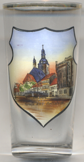
The picture on glass no. 2429 [right] shows a view of the
post
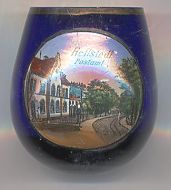
The history of Walbeck castle [left, no. 3614] goes back to Walbeck
monastery which had been founded in 985 (consecrated in 997). Severly damaged during the Peasants' War in 1525, the
monastery was dissolved in 1546. The present castle was built in 1765 on the foundation walls of the old monastery.
Later on, the park with an extensive orchard was laid out. The domains, which had been a privagte property, were
dispossessed in 1945 and were made a 'Volkseigenes Gut' ('People-Owned Property'), a state-owned farm in the German
Democratic Republic. During that period, Walbeck castle became an agricultural training facility with a well-known
horse breeding business. After the German re-unification in 1989, the domains were privatised and changed owners
frequently. After a change in ownership in 2011, an extensive photovoltaic system was installed on the roofs of the castle.
Its financial proceeds shall be used for the renovation of the castle.
[https://de.wikipedia.org/wiki/Hettstedt;
https://de.wikipedia.org/wiki/Walbeck_(Hettstedt);
https://de.wikipedia.org/wiki/Schloss_Walbeck_(Hettstedt)]
![[scale]](lineal.jpg)