
|
|
| ÖSTERREICH | AUSTRIA |
| Bundesland: Oberösterreich | Upper Austria |
| Bezirk: Wels-Land |
map →
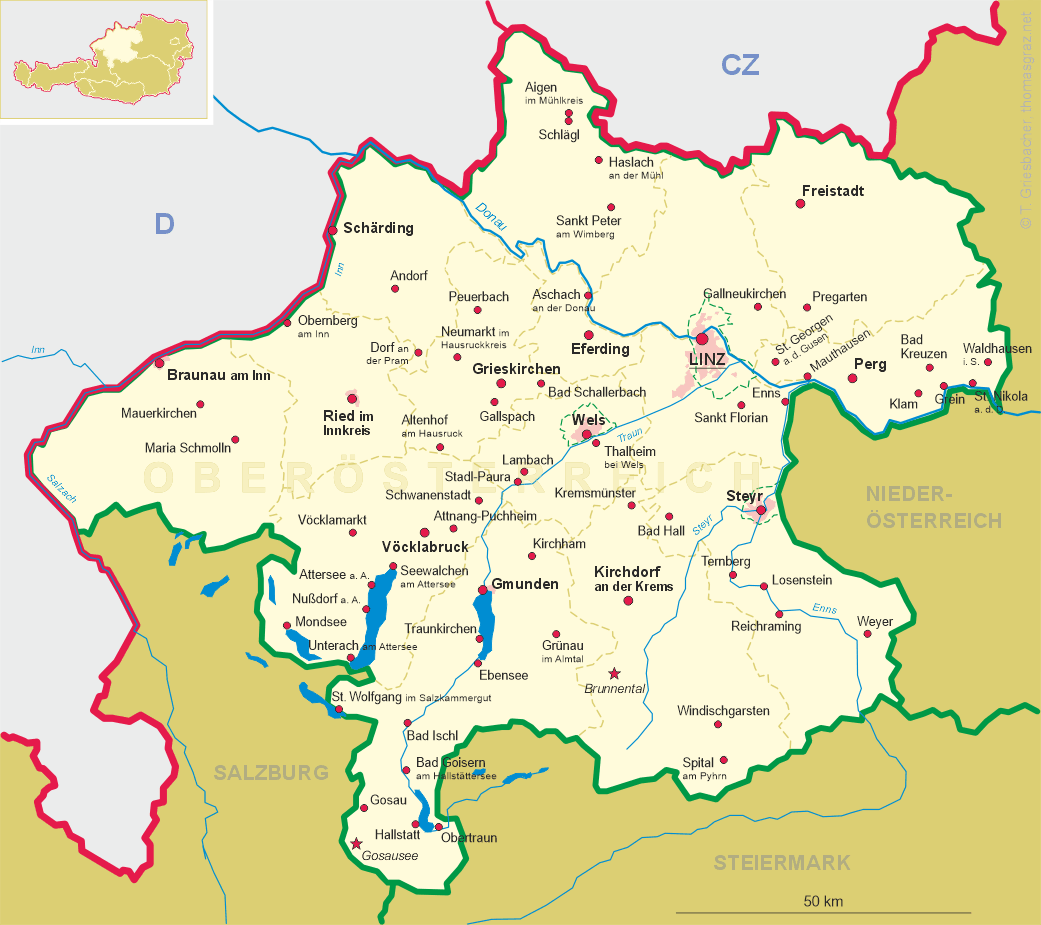
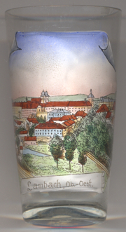 Lambach is situated at an altitude of 367 m on the river Traun in the Hausruck district of Upper Austria.
The municipality has a population of about 3,400 (2016). Lambach obtained the status os a market town in 1365.
Lambach is situated at an altitude of 367 m on the river Traun in the Hausruck district of Upper Austria.
The municipality has a population of about 3,400 (2016). Lambach obtained the status os a market town in 1365.
 Lambach Abbbey was founded in about 1040 by Count Arnold II of
Lambach-Wels. His son, Bishop Adalbero of Würzburg (later canonised),
changed the monastery into a Benedictine abbey in 1056, which it has been since. During the 17th and 18th centuries
a great deal of work in the Baroque style was carried out, much of it by the Carlone family. Lambach escaped the dissolution
of the monasteries of Emperor Joseph II in the 1780s. It was however dissolved by the National Socialists in 1941 and
the premises were used for the accommodation of a Nazi school and training institution. The Benedictines were exiled or
taken for forced labour. The dispossessed monastic community returned to Lambach Abbey after the end of World War II.
Lambach Abbbey was founded in about 1040 by Count Arnold II of
Lambach-Wels. His son, Bishop Adalbero of Würzburg (later canonised),
changed the monastery into a Benedictine abbey in 1056, which it has been since. During the 17th and 18th centuries
a great deal of work in the Baroque style was carried out, much of it by the Carlone family. Lambach escaped the dissolution
of the monasteries of Emperor Joseph II in the 1780s. It was however dissolved by the National Socialists in 1941 and
the premises were used for the accommodation of a Nazi school and training institution. The Benedictines were exiled or
taken for forced labour. The dispossessed monastic community returned to Lambach Abbey after the end of World War II.
[https://de.wikipedia.org/wiki/Lambach, https://en.wikipedia.org/wiki/Lambach;
https://en.wikipedia.org/wiki/Lambach_Abbey]
![[scale]](lineal.jpg)