
|
|
| ÖSTERREICH | AUSTRIA |
| Bundesland: Oberösterreich | Upper Austria |
| Stadt: Wels |
map →
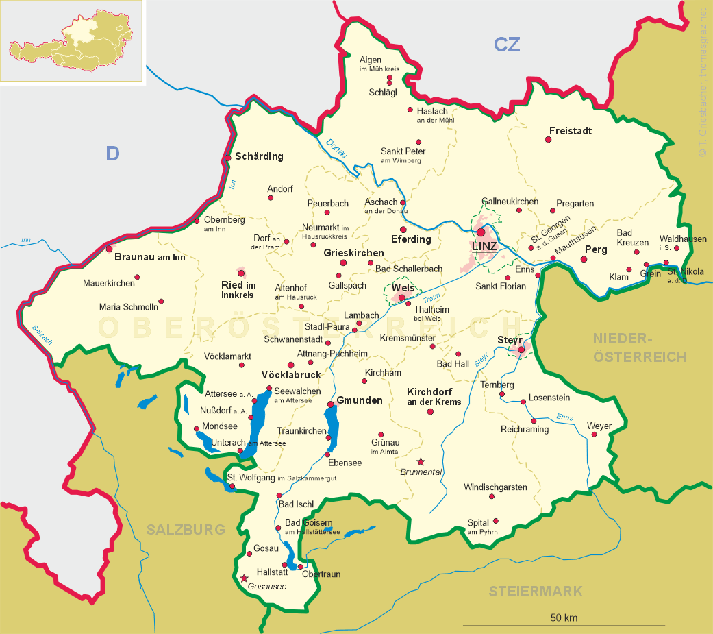
Wels is situated at an elevation of 317 m on the river Traun ans is the second-alrgest town in Upper Austria.
During the 2nd century the former celtic town became a Roman administrative centre (municipium Aelium Ovilava), at times
for some time it was the capital of the province Noricum. During the 3rd century it gradually grew into a large town (colonia Aurelia Antoniniana Ovilava).
When Noricum was divided into two parts around AD 300, Ovilava became the capital of Noricum ripiense. When the Romans left the country
in 488, the town too was abandoned. Around 600 the area was inhabited again, and Wels was first mentioned as
castrum Uueles in 776. By 1215 it had obtained the status of a market town, and by 1222 that of a town.
Under the rule of the Babenbergs and later of the Habsburgs, Wels received several privileges and became an important trading place.
The town is also famous for being the place of death of Emperor Maximilian I (d.1519). During the 18th century,
large parts of the town were rebuilt in Baroque style. During the 19th century, the industry grew, especially after the carriage railway from
 Budweis (České Budějovice) via Linz and Wels to Gmunden
was opened in 1835/36. In 1854/55 the horse-drawn carriages were replaced by steam engines. During World War II
the town suffered heavy damages. In 1964 the town obtained the status of an independent chartered town.
Budweis (České Budějovice) via Linz and Wels to Gmunden
was opened in 1835/36. In 1854/55 the horse-drawn carriages were replaced by steam engines. During World War II
the town suffered heavy damages. In 1964 the town obtained the status of an independent chartered town.
The  Traun bridge [left, no. 273: far left] connects Wels and Thalheim bei Wels.
The iron bridge was completed in 1901 after the river had destroyed the former wooden bridge in 1899. The bridge is still
in use today and is a landmark of Wels.
Traun bridge [left, no. 273: far left] connects Wels and Thalheim bei Wels.
The iron bridge was completed in 1901 after the river had destroyed the former wooden bridge in 1899. The bridge is still
in use today and is a landmark of Wels.
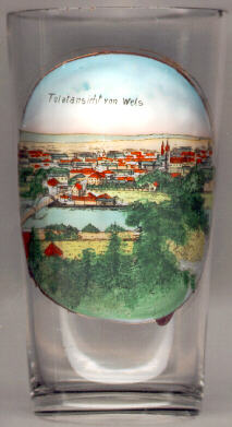
Glass no. 4021 [near left] shows a view of the square
Kaiser-Josef-Platz Hotel Greif
[https://www.meinbezirk.at/wels-wels-land/c-freizeit/bei-einem-rundgang-alles-wissenswerte-ueber-den-kaiser-josef-platz-erfahren_a2223051;
https://de.wikipedia.org/wiki/Stadttheater_Greif]
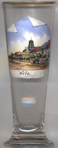
The Semmelturm [right, no. 323: centre background] was built in 1733.
Its popular name ('bun tower') came from a baker's shop that was located in the building.
The tower was demolished in 1959 to make room for a modern high-rise building.
Until 1859, the railway line from Linz via Wels to Lambach went right through the building depicted in blue to the left of the Semmelturm.
The former Spitalkirche (hospital church) [right, no. 323: right] was built in the 14th century
as the church (St. Elisabeth) of the citizens' hospice. The Baroque western façade was created in 1712.
In 1829 the church was purchased by the city of Wels and was converted to a theatre. In 1904 it was closed because it had fallen into delapidation.
Today the edifice has been modernized and is used for several shops. Only the façade has been reconstructed after the orginal.
In front of the church, the picture on glass no. 323 [right] shows the
monument
[https://www.nachrichten.at/oberoesterreich/wels/Kaiser-Josef-II-wird-wieder-verrueckt;art67,27474]
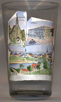
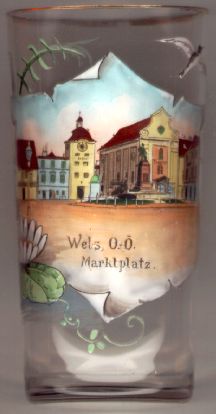
The Town Hall [near left, no. 2674: top right picture]
was created in 1738–1739 by a remodeling in Baroque style of the old town hall which had been built in 1491/1492 and enlarged in 1587.
The design was created by the architect Johann Michael Prunner from Linz. In 1894 the building had become almost derelict so
that the city's administration temporarily had to move out of the building. During the ensuing restration of the building, many Baroque details
were removed. The lower building behind the town hall (shown in white on the right end), the
Gerichtsdienerstöckl (court ushers building) had been used as a prison at least since the 16th century. This building was demolished
in 1963 and was replaced by a new 5-storey building.
[http://www.wels.gv.at/multimedia/wels/html/architekturfuehrer/entstehungsjahr/barock/rathaus/rathaus.htm]
The fountain shown in front of the town hall, the Stadtbrunnen
[http://www.tiscover.com/at/guide/5,de,SCH1/objectId,SIG558755at,_area,reisefuehrer_sommer,ffs,2,parentId,RGN20at/intern.html]
The top left picture on glass no. 2674 [left] shows the pilgrimage church Maria Schauersberg, located in the neighbouring
municipality of Thalheim bei Wels [see there].
![[scale]](lineal.jpg)