
|
|
| DEUTSCHLAND | GERMANY |
| Bundesland: Baden-Württemberg | |
| Regierungsbezirk: Karlsruhe | |
| Landkreis: Rhein-Neckar-Kreis |
map →

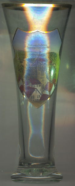 Neckarbischofsheim is situated at an elevation of 171 m between the Baden-Württemberg regions
Kraichgau and Kleiner Odenwald, about 30 km southeast of Heidelberg. The municipality has
a population of about 4,000 (2017).
Neckarbischofsheim is situated at an elevation of 171 m between the Baden-Württemberg regions
Kraichgau and Kleiner Odenwald, about 30 km southeast of Heidelberg. The municipality has
a population of about 4,000 (2017).
Biscovesheim was first mentioned in a documenting dating from 988 AD. By 1378 it had obtained the status of a town. Since the 14th century, the town was in possession of the lords of Helmstatt. The Reformation was introduced between 1525/26 and 1560. Following the Reichsdeputationshauptschluss of 1803 the town passed to the duchy (1806 grand duchy) of Baden and the name of the town was changed to Neckarbischofsheim to distinguish it from two other towns in the grand duchy that also were known as Bischofsheim: Tauberbischofsheim and Rheinbischofsheim (today part of Rheinau). Since 1810 it was seat of the district Neckarbischofsheim until 1864 when the district was incorporated into the district Sinsheim, which in turn was dissolved in 1972 and was divided between the new districts Rhein-Neckarkreis (capital Heidelberg; including Sinsheim and Neckarbischofsheim) and Heilbronn.
The  Hoher Turm (High Tower, on glass no. 3597 [left] labeled
Fünfeckiger Turm, 'pentagonal tower') was built in 1448 on the highest point of the town's fortifications.
Since the late 17th century the tower as used as a dungeon. The roof wih its small belfry was added in 1726.
Tody the tower is home of a museum of local history.
Hoher Turm (High Tower, on glass no. 3597 [left] labeled
Fünfeckiger Turm, 'pentagonal tower') was built in 1448 on the highest point of the town's fortifications.
Since the late 17th century the tower as used as a dungeon. The roof wih its small belfry was added in 1726.
Tody the tower is home of a museum of local history.
[https://de.wikipedia.org/wiki/Neckarbischofsheim;
https://de.wikipedia.org/wiki/Hoher_Turm_(Neckarbischofsheim)]
![[scale]](lineal.jpg)