
|
|
| ČESKÁ REPUBLIKA | CZECH REPUBLIC |
| Ústecký kraj | Ústí nad Labem region |
| Okres: Teplice |
map →
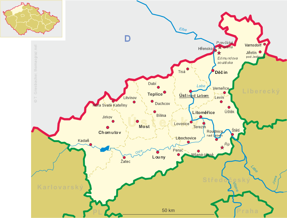
 Bílina (in German: Bilin) is situated at an elevation of 207 m in northwestern Bohema in the
valley of the Bílina River between the Central Bohemian Uplands and the Ore Mountains, between the district towns
Most and Teplice. The municipality has a populaton of about 17,200 (2018).
Bílina (in German: Bilin) is situated at an elevation of 207 m in northwestern Bohema in the
valley of the Bílina River between the Central Bohemian Uplands and the Ore Mountains, between the district towns
Most and Teplice. The municipality has a populaton of about 17,200 (2018).
During the 10th century a gord (a Slavonic fortified settlement) was built here by Bohemian rulers as a defence point against German raids from the neighbouring Saxon Eastern March (part of the Holy Roman Empire). The first written mention of provincia Belinensis dates back to 993. Since the 2nd half of the 13th century German settlers were called into the border areas of the Bohemian Kingdom, introducing German town law; this was also the case with Bílina which was first mentioned as a regular chartered town (civitas) in 1289. After 1502, Bílina was owned by the aristocratic family of Lobkowicz. Between 1938 and 1945 it was part of the Sudetenland, which was annexed by Nazi Germany. After 1945 most of the German-speaking population was expelled. After the end of the Communist regime in 1986, the Lobkowicz family regained part of the former property, including the spa, which was later sold to a private company.
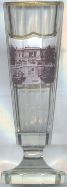
The history of the  spa goes back to 1664 when the mineral waters had already been in use.
In 1702 the Lobkowicz had the mineral spring cleaned and the very first spa guests began to visit. By the end of
19th century the spa Biliner Sauerbrunn (meaning "Carbonated springs of Bílina" in German) had become the pride
of the town. In 1878 a large spa complex was built in a Renaissance Revival style, designed by the Lobkowicz family
architect and builder Franz Sablik.
spa goes back to 1664 when the mineral waters had already been in use.
In 1702 the Lobkowicz had the mineral spring cleaned and the very first spa guests began to visit. By the end of
19th century the spa Biliner Sauerbrunn (meaning "Carbonated springs of Bílina" in German) had become the pride
of the town. In 1878 a large spa complex was built in a Renaissance Revival style, designed by the Lobkowicz family
architect and builder Franz Sablik.
[https://de.wikipedia.org/wiki/Bílina, https://en.wikipedia.org/wiki/Bílina]
![[scale]](lineal.jpg)