
|
|
| ČESKÁ REPUBLIKA | CZECH REPUBLIC |
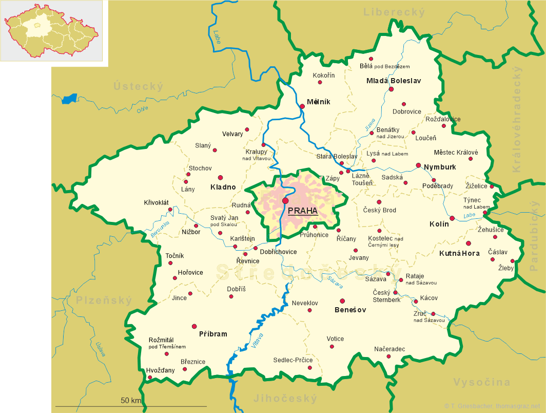
| Středočeský kraj | Central Bohemia region |
| Okres: Mělník |
map →
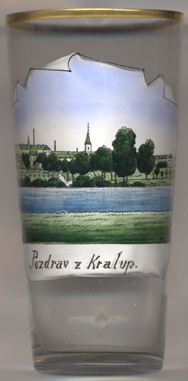 Kralupy nad Vltavou is situated at an elevation of 176 m on the Vltava (Moldau) river, about 20 km northwest of
Prague. The municipality has a populaton of about 18,200 (2019).
Kralupy nad Vltavou is situated at an elevation of 176 m on the Vltava (Moldau) river, about 20 km northwest of
Prague. The municipality has a populaton of about 18,200 (2019).
The oldest written document mentioning the place dates from 1253 as a property of the Knights of the Cross with the Red Star. In 1619 it came in possession of the lords (1623 princes) of Popel-Lobkowitz (Lobkovic). After the Battle of the White Mountain (today part of Prague), Kralupy was returned to the order, who held it until 1848. In 1902 Kralupy obtained the official status of a town. In 1942, the district Kladno was dissolved and Kralupy became part of the district Roudnice, but this was reverted in 1945. In 1960 it became part of the district Mělnik.
the  church of the Assumption of the Virgin Mary and of St. Wenceslas [left,
no. 3702: background right] was built in Gothic revival style in 1894 1895. The church tower has a height
of 63 metres. The church has the status of a cultural monument of the Czech Republic.
church of the Assumption of the Virgin Mary and of St. Wenceslas [left,
no. 3702: background right] was built in Gothic revival style in 1894 1895. The church tower has a height
of 63 metres. The church has the status of a cultural monument of the Czech Republic.
[https://de.wikipedia.org/wiki/Kralupy_nad_Vltavou;
https://cs.wikipedia.org/wiki/Kostel_Nanebevzetí_Panny_Marie_a_svatého_Václava_(Kralupy_nad_Vltavou)]
![[scale]](lineal.jpg)