
|
|
| DEUTSCHLAND | GERMANY |
| Bundesland: Niedersachsen | Lower Saxony |
| Landkreise: Heidekreis, Harburg |
map →
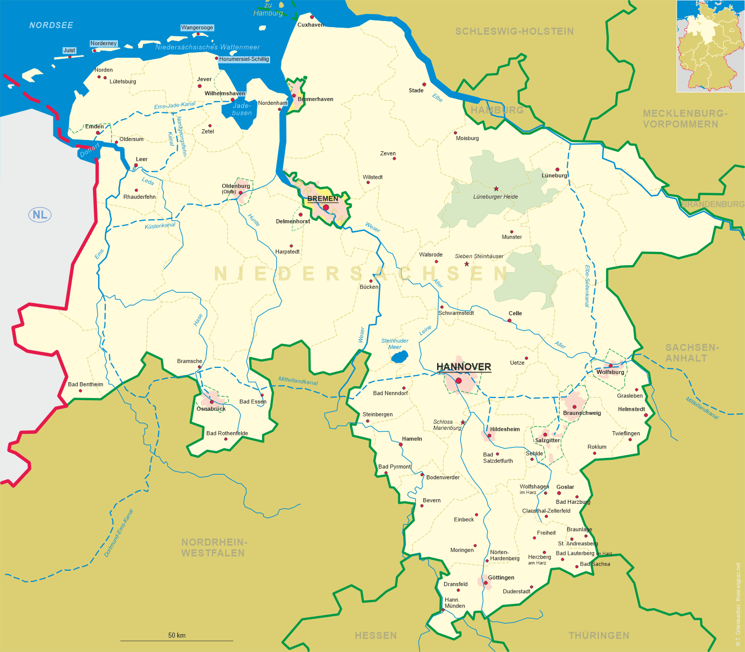
 The Lüneburger Heide (Lüneburg Heath) is a large area of heath, geest, and woodland in the northeastern part of the state of
Lower Saxony in northern Germany. It forms part of the hinterland for the cities of Hamburg, Hannover
and Bremen and is named after the town of Lüneburg. Most of the area is a nature reserve. Lüneburg Heath has
extensive areas of heathland, typical of those that covered most of the North German countryside until about 1800, but which have almost completely
disappeared in other areas. The heaths were formed after the Neolithic period by overgrazing of the once widespread forests on the poor sandy soils
of the geest, as this slightly hilly and sandy terrain in northern Europe is called. Lüneburg Heath is therefore a historic cultural landscape.
The remaining areas of heath are kept clear mainly through grazing, especially by a North German breed of moorland sheep called the Heidschnucke.
Due to its unique landscape, Lüneburg Heath is a popular tourist destination.
The Lüneburger Heide (Lüneburg Heath) is a large area of heath, geest, and woodland in the northeastern part of the state of
Lower Saxony in northern Germany. It forms part of the hinterland for the cities of Hamburg, Hannover
and Bremen and is named after the town of Lüneburg. Most of the area is a nature reserve. Lüneburg Heath has
extensive areas of heathland, typical of those that covered most of the North German countryside until about 1800, but which have almost completely
disappeared in other areas. The heaths were formed after the Neolithic period by overgrazing of the once widespread forests on the poor sandy soils
of the geest, as this slightly hilly and sandy terrain in northern Europe is called. Lüneburg Heath is therefore a historic cultural landscape.
The remaining areas of heath are kept clear mainly through grazing, especially by a North German breed of moorland sheep called the Heidschnucke.
Due to its unique landscape, Lüneburg Heath is a popular tourist destination.
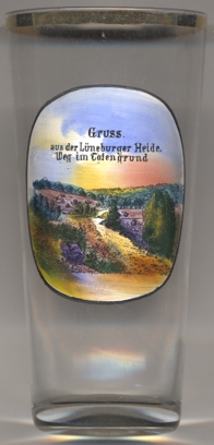
Glass no. 4085 shows a view of  Totengrund
[https://en.wikipedia.org/wiki/L%C3%BCneburg_Heath]
![[scale]](lineal.jpg)