
|
|
| DEUTSCHLAND | GERMANY |
| Bundesland: Freistaat Thüringen | Thuringia |
| Landkreis: Greiz |
map →
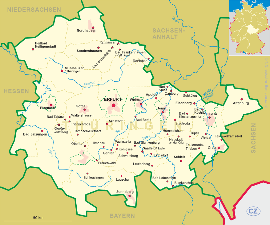
 Teichwolframsdorf is situated at an elevation of 349 m in the south of the Werdauer Wald region of eastern Thuringia. The community has a
population of about 2,500 and is part of the municipality Mohlsdorf-Teichwolframsdorf.
Teichwolframsdorf is situated at an elevation of 349 m in the south of the Werdauer Wald region of eastern Thuringia. The community has a
population of about 2,500 and is part of the municipality Mohlsdorf-Teichwolframsdorf.
The oldest written documetn that wmentions the place dates from 1278. During the period of the Holy Roman Empire it was part of the Electorate of Saxony. When the Electorate, following the Congress of Vienna (1814–1815) had to cede territories, Teichwolframsdorf became part of the Grand Duchy of Saxe-Weimar-Eisenach, where, since 1850, it was placed in the administrative district of Neustadt an der Orla. Since 1920 it was part of the German state of Thuringia and within this state since 1922 part of the district Greiz. The neighbouring community of Sorge-Settendorf was incorporated into Teichwolframsdorf in 1974, Großkunsdorf followed in 1994, Kleinreinsdorf and Walterdorf bei Berga/Elster in 1997. On 1 January 2012 Mohlsdorf and Teichwolframsdorf were merged to a single municipality, Mohlsdorf-Teichwolframsdorf.
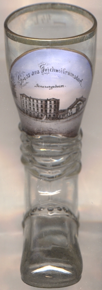
The picture on glass no. 4138 [left] is labeled as
 Genesungsheim
[https://de.wikipedia.org/wiki/Teichwolframsdorf;
https://www.fallingrain.com/world/GM/15/Teichwolframsdorf.html]
![[scale]](lineal.jpg)